Génissieux
| Génissieux | |
|---|---|
|
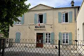
Town hall | |
 Génissieux | |
|
Location within Auvergne-Rhône-Alpes region  Génissieux | |
| Coordinates: 45°05′04″N 5°05′07″E / 45.0844°N 5.0853°ECoordinates: 45°05′04″N 5°05′07″E / 45.0844°N 5.0853°E | |
| Country | France |
| Region | Auvergne-Rhône-Alpes |
| Department | Drôme |
| Arrondissement | Valence |
| Canton | Romans-sur-Isère-2 |
| Government | |
| • Mayor (2008–2014) | Christian Bordaz |
| Area1 | 8.93 km2 (3.45 sq mi) |
| Population (2008)2 | 2,022 |
| • Density | 230/km2 (590/sq mi) |
| Time zone | CET (UTC+1) |
| • Summer (DST) | CEST (UTC+2) |
| INSEE/Postal code | 26139 / 26750 |
| Elevation |
177–303 m (581–994 ft) (avg. 164 m or 538 ft) |
|
1 French Land Register data, which excludes lakes, ponds, glaciers > 1 km² (0.386 sq mi or 247 acres) and river estuaries. 2 Population without double counting: residents of multiple communes (e.g., students and military personnel) only counted once. | |
Génissieux is a commune in the Drôme department in southeastern France.
Population
| Historical population | ||
|---|---|---|
| Year | Pop. | ±% |
| 1911 | 609 | — |
| 1962 | 589 | −3.3% |
| 1968 | 655 | +11.2% |
| 1975 | 765 | +16.8% |
| 1982 | 1,125 | +47.1% |
| 1990 | 1,584 | +40.8% |
| 1999 | 1,826 | +15.3% |
| 2008 | 2,022 | +10.7% |
See also
References
| Wikimedia Commons has media related to Génissieux. |
This article is issued from Wikipedia - version of the 10/28/2016. The text is available under the Creative Commons Attribution/Share Alike but additional terms may apply for the media files.