Gehlenbeck
| Gehlenbeck | |
|---|---|
| Ortsteil of Lübbecke | |
 Gehlenbeck | |
Location of Gehlenbeck within Lübbecke 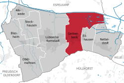 | |
| Coordinates: 52°18′37″N 8°38′54″E / 52.31028°N 8.64833°ECoordinates: 52°18′37″N 8°38′54″E / 52.31028°N 8.64833°E | |
| Country | Germany |
| State | North Rhine-Westphalia |
| District | Minden-Lübbecke |
| Town | Lübbecke |
| Area | |
| • Total | 11.13 km2 (4.30 sq mi) |
| Population (2007-12-31) | |
| • Total | 3,310 |
| • Density | 300/km2 (770/sq mi) |
| Time zone | CET/CEST (UTC+1/+2) |
| Postal codes | 32312 |
| Dialling codes | 05741 |
Gehlenbeck is a village in the East Westphalian borough of Lübbecke in the county of Minden-Lübbecke in North Germany. The former clustered village (Haufendorf) is the second most populous village today in the borough. A stream flows through the village, the Gehle Beke (High German: gelber Bach; English: "Yellow Brook"), that once gave its name to the village. The village's parish has an area of around 11 km². With 297 inhabitants per km² Gehlenbeck is rather less densely settled than the borough of Lübbecke (398 people/km²).
References
Literature
- Werner Fabis: Gehlenbeck - Ein Dorf im Spiegel der Geschichte. Herausgeber: Heimatverein Gehlenbeck e. V.
External links
Villages in the borough of Lübbecke | ||
|---|---|---|
| ||
This article is issued from Wikipedia - version of the 5/17/2015. The text is available under the Creative Commons Attribution/Share Alike but additional terms may apply for the media files.