Gerswalde
| Gerswalde | |
|---|---|
 Gerswalde | |
Location of Gerswalde within Uckermark district 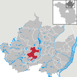 | |
| Coordinates: 53°10′00″N 13°46′00″E / 53.16667°N 13.76667°ECoordinates: 53°10′00″N 13°46′00″E / 53.16667°N 13.76667°E | |
| Country | Germany |
| State | Brandenburg |
| District | Uckermark |
| Municipal assoc. | Gerswalde |
| Government | |
| • Mayor | Oliver Nowatzki |
| Area | |
| • Total | 96.79 km2 (37.37 sq mi) |
| Population (2015-12-31)[1] | |
| • Total | 1,604 |
| • Density | 17/km2 (43/sq mi) |
| Time zone | CET/CEST (UTC+1/+2) |
| Postal codes | 17268 |
| Dialling codes | 039887 |
| Vehicle registration | UM |
| Website | www.gerswalde-uckermark.de |
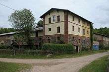
Arnimswalde
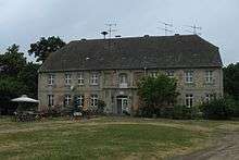
Manor in Friedenfelde
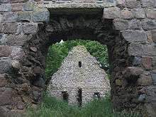
Church ruin in Berkenlatten
Gerswalde is a municipality in the Uckermark district, in Brandenburg, Germany.
Demography
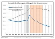
Development of Population since 1875 within the Current Boundaries (Blue Line: Population; Dotted Line: Comparison to Population Development of Brandenburg state; Grey Background: Time of Nazi rule; Red Background: Time of Communist rule)
|
|
|
|
References
- ↑ "Bevölkerung im Land Brandenburg nach amtsfreien Gemeinden, Ämtern und Gemeinden 31. Dezember 2015 (Fortgeschriebene amtliche Einwohnerzahlen auf Grundlage des Zensus 2011)". Amt für Statistik Berlin-Brandenburg (in German). 2016.
- ↑ Detailed data sources are to be found in the Wikimedia Commons.Population Projection Brandenburg at Wikimedia Commons
| Wikimedia Commons has media related to Gerswalde. |
This article is issued from Wikipedia - version of the 7/6/2015. The text is available under the Creative Commons Attribution/Share Alike but additional terms may apply for the media files.