Gomsi
 | |
| Location | Rani Village, East Siang District, Arunachal Pradesh, India |
|---|---|
| Region |
|
| Coordinates | 28°04′N 95°20′E / 28.07°N 95.33°ECoordinates: 28°04′N 95°20′E / 28.07°N 95.33°E |
| Type | Settlement |
| History | |
| Builder | expected as Ahom King |
| Founded | Early Medieval Period, 13th century (probably pre-Ahom) |
| Site notes | |
| Condition | Ruined |
| Ownership | Public |
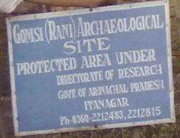
| Management | Archaeological Survey of India |
| Public access | Yes |
| It is now undertaken by the Govt. of India | |
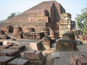
Gomsi is an ancient archaeological site located between Rani Village and Sika Tode[1] in East Siang District, Arunachal Pradesh, India. It is associated with the 13th-century Ahom Kingdom, which was located at the field of Rani Village, about 15 km from the town of Pasighat.[2]
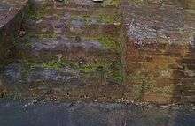
Gomsi Archaeological Site
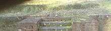
Gomsi Archaeological Site Landscape View
References
- ↑ Saroh, Benji (7 June 2010). "PWD Link road urgent attention". The Arunachal Times. Retrieved 24 November 2014.
- ↑ Apang, Kalom (1 June 2010). "We should take a lesson from Siang flood-2000". The Arunachal Times. Retrieved 24 November 2014.
- Indian Archaeology 1996-1997 (PDF). New Delhi: Archaelogical Survey of India. 2002. Retrieved 24 November 2014.
External links
- Gomsi. "What To See!!". East Siang District. Retrieved 24 November 2014.
Geographical location
 |
Pasighat | | ||
| Rani Village | |
Sika Tode | ||
| ||||
| | ||||
| Ruksin |
This article is issued from Wikipedia - version of the 9/9/2016. The text is available under the Creative Commons Attribution/Share Alike but additional terms may apply for the media files.