Graça Aranha, Maranhão
| Graça Aranha | |
|---|---|
| Municipality | |
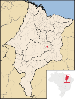 Location in Maranhão state | |
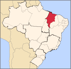
 Graça Aranha Location in Brazil | |
| Coordinates: 5°24′36″S 44°20′02″W / 5.41000°S 44.33389°WCoordinates: 5°24′36″S 44°20′02″W / 5.41000°S 44.33389°W | |
| Country |
|
| Region | Northeast Region |
| State | Maranhão |
| Area | |
| • Total | 271 km2 (105 sq mi) |
| Population | |
| • Total | 6,142 |
| • Density | 23/km2 (59/sq mi) |
| Time zone | BRT (UTC-3) |
Graça Aranha is a municipality in the state of Maranhão, Brazil, founded in 1959.[1]
- Altitude: 192m.
- Population: 6,142 inhabitants (2015)
- Area: 271 km²
- Demographic density: 16.82 hab/km²
- Postal code: 65785-000
- Microregion: Presidente Dutra
References
- ↑ "IBGE | Cidades | Maranhão | Graça Aranha". cidades.ibge.gov.br. Retrieved 2016-05-19.
This article is issued from Wikipedia - version of the 5/19/2016. The text is available under the Creative Commons Attribution/Share Alike but additional terms may apply for the media files.