Greenhorn Mountains (Oregon)
This article is about mountain range in Oregon. For mountain range in California, see Greenhorn Mountains.
| Greenhorn Mountains | |
|---|---|
| Highest point | |
| Elevation | 2,469 m (8,100 ft) |
| Geography | |
| Country | United States |
| State | Oregon |
| District | Grant County |
| Range coordinates | 44°42′50″N 118°33′39″W / 44.7138°N 118.5608°WCoordinates: 44°42′50″N 118°33′39″W / 44.7138°N 118.5608°W |
| Topo map | USGS Vinegar Hill |
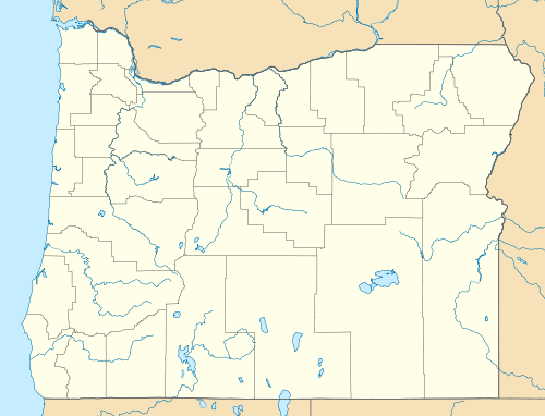
The Greenhorn Mountains are a mountain range in Grant County, Oregon.[1]
References
This article is issued from Wikipedia - version of the 9/4/2016. The text is available under the Creative Commons Attribution/Share Alike but additional terms may apply for the media files.