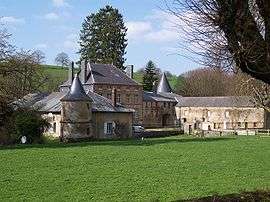
Gruyères, Ardennes
| Gruyères | ||
|---|---|---|
 | ||
| ||
 Gruyères | ||
|
Location within Grand Est region 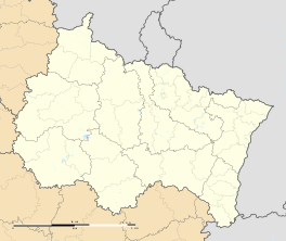 Gruyères | ||
| Coordinates: 49°42′38″N 4°36′09″E / 49.7106°N 4.6025°ECoordinates: 49°42′38″N 4°36′09″E / 49.7106°N 4.6025°E | ||
| Country | France | |
| Region | Grand Est | |
| Department | Ardennes | |
| Arrondissement | Charleville-Mézières | |
| Canton | Signy-l'Abbaye | |
| Intercommunality | Crêtes Préardennaises | |
| Government | ||
| • Mayor (2008–2014) | Bernard Blaimont | |
| Area1 | 5.48 km2 (2.12 sq mi) | |
| Population (2008)2 | 65 | |
| • Density | 12/km2 (31/sq mi) | |
| Time zone | CET (UTC+1) | |
| • Summer (DST) | CEST (UTC+2) | |
| INSEE/Postal code | 08201 / 08430 | |
| Elevation |
211–306 m (692–1,004 ft) (avg. 220 m or 720 ft) | |
|
1 French Land Register data, which excludes lakes, ponds, glaciers > 1 km² (0.386 sq mi or 247 acres) and river estuaries. 2 Population without double counting: residents of multiple communes (e.g., students and military personnel) only counted once. | ||

Gruyères is a commune in the Ardennes department in northern France.
Population
| Historical population | ||
|---|---|---|
| Year | Pop. | ±% |
| 1962 | 28 | — |
| 1968 | 34 | +21.4% |
| 1975 | 44 | +29.4% |
| 1982 | 49 | +11.4% |
| 1990 | 52 | +6.1% |
| 1999 | 51 | −1.9% |
| 2008 | 65 | +27.5% |
See also
References
| Wikimedia Commons has media related to Gruyères, Ardennes. |
This article is issued from Wikipedia - version of the 3/30/2014. The text is available under the Creative Commons Attribution/Share Alike but additional terms may apply for the media files.