Hamarjung
| Hamarjung हमरजुङ | |
|---|---|
| Village development committee | |
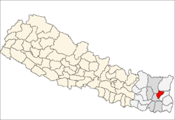
 Hamarjung Location in Nepal | |
| Coordinates: 27°02′N 87°27′E / 27.04°N 87.45°ECoordinates: 27°02′N 87°27′E / 27.04°N 87.45°E | |
| Country |
|
| Zone | Kosi Zone |
| District | Terhathum District |
| Population (1991) | |
| • Total | 2,956 |
| Time zone | Nepal Time (UTC+5:45) |
| Postal code | 57106 |
| Area code(s) | 026 |
Hamarjung is a village development committee in the Himalayas of Terhathum District in the Kosi Zone of eastern Nepal. At the time of the 1991 Nepal census it had a population of 2956 people living in 593 individual households.[1]
References
- ↑ "Nepal Census 2001". Nepal's Village Development Committees. Digital Himalaya. Retrieved 19 November 2008.
External links
Headquarter: Myanglung | ||
 | ||
http://places.thlib.org/features/1604
This article is issued from Wikipedia - version of the 6/23/2014. The text is available under the Creative Commons Attribution/Share Alike but additional terms may apply for the media files.