Hemrin Dam
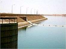 Upstream side of the dam | |
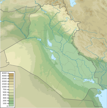 Location of in Iraq | |
| Official name | Hemrin Dam |
|---|---|
| Country | Iraq |
| Location | 100 km northeast of Baghdad, Iraq, Diyala Governorate, Iraq |
| Coordinates | 34°06′52″N 44°58′04″E / 34.11444°N 44.96778°ECoordinates: 34°06′52″N 44°58′04″E / 34.11444°N 44.96778°E |
| Status | Operational |
| Construction began | 1976 |
| Opening date | 1981 |
| Owner(s) | Ministry of Water Resources |
| Dam and spillways | |
| Impounds | Diyala River |
| Height | 53 m (174 ft) |
| Length | 3,360 m (11,020 ft) |
| Reservoir | |
| Creates | Hemrin Reservoir |
| Total capacity | 2,040,000,000 m3 (1,650,000 acre·ft) |
| Power station | |
| Commission date | 1981 |
| Installed capacity | 50 MW |
The Hemrin Dam is a dam on the Diyala River 100 km northeast of Baghdad, Iraq. The main purpose of the dam is flood control, irrigation and hydroelectric generation. Its power station has a 50 MW capacity. The dam and the attached power house were built in years 1976-1981 by the then Yugoslav company GIK Hidrogradnja (of Sarajevo, now Bosnia-Herzegovina). All the equipment (gates, turbines, generators) were also supplied by the then-Yugoslav companies.[1]
See also
- Darbandikhan Dam – upstream
- Diyala Weir – downstream
References
- ↑ "Energy and Hydroelectric Power". Iraq Ministry of Water Resources. Retrieved 12 June 2011.
External links
 Media related to Hemrin Dam at Wikimedia Commons
This article is issued from Wikipedia - version of the 9/16/2015. The text is available under the Creative Commons Attribution/Share Alike but additional terms may apply for the media files.