Hectorspruit
| Hectorspruit | |
|---|---|
|
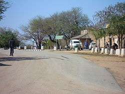
A street in Hectorspruit | |
 Hectorspruit  Hectorspruit  Hectorspruit
| |
| Coordinates: 25°26′S 31°41′E / 25.433°S 31.683°ECoordinates: 25°26′S 31°41′E / 25.433°S 31.683°E | |
| Country | South Africa |
| Province | Mpumalanga |
| District | Ehlanzeni |
| Municipality | Nkomazi |
| Area[1] | |
| • Total | 10.26 km2 (3.96 sq mi) |
| Population (2011)[1] | |
| • Total | 3,096 |
| • Density | 300/km2 (780/sq mi) |
| Racial makeup (2011)[1] | |
| • Black African | 77.9% |
| • Coloured | 0.8% |
| • Indian/Asian | 0.4% |
| • White | 20.8% |
| • Other | 0.1% |
| First languages (2011)[1] | |
| • Swazi | 55.0% |
| • Afrikaans | 18.6% |
| • Tsonga | 17.0% |
| • English | 4.1% |
| • Other | 5.3% |
| PO box | 1330 |
| Area code | 013 |
Hectorspruit (also Emjejane) is a small farming town situated between Kaapmuiden and Komatipoort on a southern tributary of the Crocodile River in Mpumalanga, South Africa. The farms in the region produce sugarcane, subtropical fruit and vegetables. The town and stream is named after a dog belonging to S de Kock, chief surveyor of the Pretoria - Delagoa Bay railway line.
Hamlet some 30 km west of Komatipoort and 80 km north-east of Pigg's Peak. Named after a tributary of the Crocodile River, the Hectorspruit, which is said to take its name from a hunting-dog which died there from a tsetse fly bite.[2]
References
- 1 2 3 4 "Main Place Hectorspruit". Census 2011.
- ↑ "Dictionary of Southern African Place Names (Public Domain)". Human Science Research Council. p. 202.
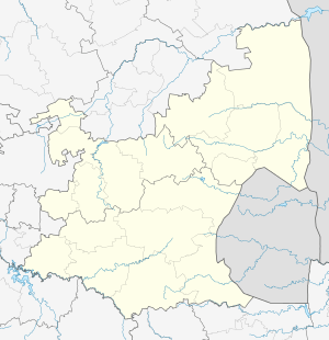
Municipalities and communities of Ehlanzeni District Municipality, Mpumalanga | ||
|---|---|---|
District seat: Nelspruit | ||
| Mbombela | .svg.png) | |
| Nkomazi | ||
| Thaba Chweu | Blyde River Canyon • Bosoord • Graskop • Hendriksdal • Krugerspos • Leroro • Lydenburg • Maartenshoop • Mashishing • Mauchsberg • Matibidi • Moremela • Pilgrim's Rest • Sabie • Simile | |
| Umjindi | ||
| Bushbuckridge | ||
This article is issued from Wikipedia - version of the 8/18/2016. The text is available under the Creative Commons Attribution/Share Alike but additional terms may apply for the media files.