Herselt
| Herselt | |||
|---|---|---|---|
| Municipality | |||
.JPG) | |||
| |||
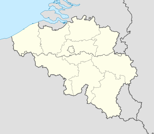 Herselt Location in Belgium | |||
|
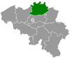
Location of Herselt in the province of Antwerp 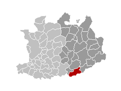 | |||
| Coordinates: 51°03′N 04°53′E / 51.050°N 4.883°ECoordinates: 51°03′N 04°53′E / 51.050°N 4.883°E | |||
| Country | Belgium | ||
| Community | Flemish Community | ||
| Region | Flemish Region | ||
| Province | Antwerp | ||
| Arrondissement | Turnhout | ||
| Government | |||
| • Mayor | Luc Peetermans (CD&V) | ||
| • Governing party/ies | CD&V | ||
| Area | |||
| • Total | 52.32 km2 (20.20 sq mi) | ||
| Population (1 January 2016)[1] | |||
| • Total | 14,491 | ||
| • Density | 280/km2 (720/sq mi) | ||
| Postal codes | 2230 | ||
| Area codes | 014, 016, 013 | ||
| Website | www.herselt.be | ||

Herselt (Dutch pronunciation: [ˈɦɛrsəlt]) is a municipality located in the Belgian province of Antwerp. The municipality comprises the towns of Herselt proper, Ramsel, Blauberg, Bergom and Varenwinkel. On January 1, 2006 Herselt had a total population of 13,836. The total area is 52.32 km² which gives a population density of 264 inhabitants per km².
Gallery
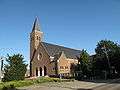 Bergom, church
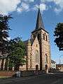 Herselt, church
References
- ↑ Population per municipality as of 1 January 2016 (XLS; 397 KB)
External links
 Media related to Herselt at Wikimedia Commons
- Official website (Dutch)
 |
Westerlo | Geel | | |
| Hulshout | |
Laakdal | ||
| ||||
| | ||||
| Begijnendijk (VBR) | Aarschot (VBR) | Scherpenheuvel-Zichem (VBR) |
This article is issued from Wikipedia - version of the 12/1/2016. The text is available under the Creative Commons Attribution/Share Alike but additional terms may apply for the media files.