Highway M22 (Ukraine)
| ||||
|---|---|---|---|---|
| Автошлях M22 | ||||
 | ||||
| Route information | ||||
| Length: | 186.5 km (115.9 mi) | |||
| Major junctions | ||||
| West end: |
(Oleksandriya) | |||
| East end: |
(Poltava) | |||
| Location | ||||
| Regions: | Kirovohrad Oblast, Poltava Oblast | |||
| Highway system | ||||
| ||||

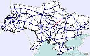
![]() is a Ukrainian international highway (M-highway) which connects Oleksandriya, Kremenchuk, and Poltava across Dnieper river.[1] The highway also connects two major transnational corridors that run along
is a Ukrainian international highway (M-highway) which connects Oleksandriya, Kremenchuk, and Poltava across Dnieper river.[1] The highway also connects two major transnational corridors that run along ![]() and
and ![]() . Along with
. Along with ![]() ,
, ![]() composes the Ukrainian portion of
composes the Ukrainian portion of ![]() that also runs from Kropyvnytskyi towards Moldavian border onto Chişinău.[2]
that also runs from Kropyvnytskyi towards Moldavian border onto Chişinău.[2]
Route
| Highway M22 | |||
| Marker | Main settlements | Notes | Highway Interchanges |
|---|---|---|---|
| 0 km | Oleksandriya | ||
| Kremenchuk | H08 | ||
| 186 km | Poltava | ||
See also
References
External links
- International Roads in Ukraine in Russian
- European Roads in Russian
| E-roads in Ukraine | ||
|---|---|---|
| International | ||
| National | ||
| Regional |
| |
| ||
This article is issued from Wikipedia - version of the 7/26/2016. The text is available under the Creative Commons Attribution/Share Alike but additional terms may apply for the media files.