Hobrede
| Hobrede | |
|---|---|
| Town | |
 | |
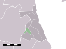 The statistical district of Hobrede in the former municipality of Zeevang. | |
| Coordinates: 52°32′42″N 4°58′51″E / 52.54500°N 4.98083°ECoordinates: 52°32′42″N 4°58′51″E / 52.54500°N 4.98083°E | |
| Country | Netherlands |
| Province | North Holland |
| Municipality | Edam-Volendam |
| Area | |
| • Total | 1.94 km2 (0.75 sq mi) |
| Population (2009)[1] | |
| • Total | 160 |
| • Density | 82/km2 (210/sq mi) |
| Time zone | CET (UTC+1) |
| • Summer (DST) | CEST (UTC+2) |
| Postal code | 1477 |
| Dialing code | 0299 |
Hobrede is a town in the Dutch province of North Holland. It is a part of the municipality of Edam-Volendam, and lies about 4 km northeast of Purmerend.
The statistical district "Hobrede", which covers the village and the surrounding countryside, has a population of around 170.[2]
References
This article is issued from Wikipedia - version of the 3/24/2016. The text is available under the Creative Commons Attribution/Share Alike but additional terms may apply for the media files.