Hurstpierpoint and Sayers Common
| Hurstpierpoint and Sayers Common | |
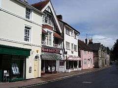 Hurstpierpoint High Street |
|
 Hurstpierpoint and Sayers Common |
|
| Area | 20.30 km2 (7.84 sq mi) [1] |
|---|---|
| Population | 6,264 [1] 2001 Census 7,112 (2011 Census)[2] |
| – density | 309/km2 (800/sq mi) |
| OS grid reference | TQ268183 |
| – London | 38 miles (61 km) N |
| Civil parish | Hurstpierpoint and Sayers Common |
| District | Mid Sussex |
| Shire county | West Sussex |
| Region | South East |
| Country | England |
| Sovereign state | United Kingdom |
| Post town | HASSOCKS |
| Postcode district | BN6 |
| Dialling code | 01273 |
| Police | Sussex |
| Fire | West Sussex |
| Ambulance | South East Coast |
| EU Parliament | South East England |
| UK Parliament | Arundel and South Downs |
| Website | http://www.hurstpierpoint-pc.org.uk/ |
|
|
Coordinates: 50°57′01″N 0°11′44″W / 50.95023°N 0.19559°W
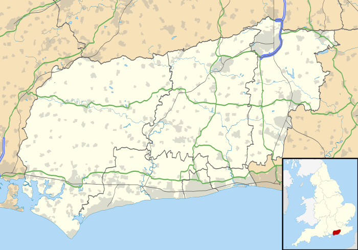
Hurstpierpoint and Sayers Common is a civil parish in the district of Mid Sussex, West Sussex England.
Settlements
Major settlements
Main articles: Hurstpierpoint and Sayers Common
Other places
- Bedlam Street
Goddards Green
References
- 1 2 "2001 Census: West Sussex – Population by Parish" (PDF). West Sussex County Council. Retrieved 3 April 2009.
- ↑ "Civil Parish population 2011". Neighbourhood Statistics. Office for National Statistics. Retrieved 29 September 2016.
This article is issued from Wikipedia - version of the 9/29/2016. The text is available under the Creative Commons Attribution/Share Alike but additional terms may apply for the media files.