Ihrlerstein
| Ihrlerstein | ||
|---|---|---|
| ||
 Ihrlerstein | ||
Location of Ihrlerstein within Kelheim district 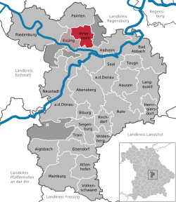 | ||
| Coordinates: 48°56′N 11°52′E / 48.933°N 11.867°ECoordinates: 48°56′N 11°52′E / 48.933°N 11.867°E | ||
| Country | Germany | |
| State | Bavaria | |
| Admin. region | Niederbayern | |
| District | Kelheim | |
| Municipal assoc. | Ihrlerstein | |
| Government | ||
| • Mayor | Josef Häckl (Freie Wähler/CSU/Unabhängige Wähler) | |
| Area | ||
| • Total | 23.10 km2 (8.92 sq mi) | |
| Population (2015-12-31)[1] | ||
| • Total | 4,226 | |
| • Density | 180/km2 (470/sq mi) | |
| Time zone | CET/CEST (UTC+1/+2) | |
| Postal codes | 93346 | |
| Dialling codes | 09441 | |
| Vehicle registration | KEH | |
| Website | www.ihrlerstein.de | |

Ihrlerstein is a municipality in the district of Kelheim in Bavaria in Germany.
References
- ↑ "Fortschreibung des Bevölkerungsstandes". Bayerisches Landesamt für Statistik und Datenverarbeitung (in German). June 2016.
Towns and municipalities in Kelheim | ||
|---|---|---|
This article is issued from Wikipedia - version of the 6/21/2015. The text is available under the Creative Commons Attribution/Share Alike but additional terms may apply for the media files.