Illinois Route 78
| ||||
|---|---|---|---|---|
| Route information | ||||
| Maintained by IDOT | ||||
| Length: | 215.51 mi[1] (346.83 km) | |||
| Existed: | 1924[2] – present | |||
| Major junctions | ||||
| South end: |
| |||
| North end: |
| |||
| Location | ||||
| Counties: | Morgan, Cass, Mason, Fulton, Knox, Peoria, Stark, Henry, Whiteside, Carroll, Jo Daviess | |||
| Highway system | ||||
| ||||

Illinois Route 78 is a major north–south highway in western Illinois. It runs from Illinois Route 104 northwest of Jacksonville north to Highway 78 at the Wisconsin state line north of Warren. This is a distance of 215.51 miles (346.83 km).[1]
Points of interest
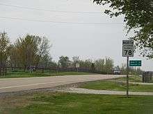
IL 78 north of Laura in Peoria County
The following historic and geographic sites can be enjoyed on Illinois Route 78, southing from south to north:
- Jim Edgar Panther Creek State Fish and Wildlife Area
- Emiquon Project
- Dickson Mounds
- Snakeden Hollow State Fish and Wildlife Area
- Johnson-Sauk Trail State Park
- Prophetstown State Recreation Area
- Morrison-Rockwood State Park
- Apple River Canyon State Park
Major intersections
| County | Location | mi | km | Destinations | Notes |
|---|---|---|---|---|---|
| Morgan | Jacksonville | 0.00 | 0.00 | Southern terminus of IL 78 | |
| Cass | Virginia | ||||
| Mason | Havana | Begin/end concurrency with US 136 and IL 97 | |||
| Illinois River | Scott W. Lucas Bridge | ||||
| Fulton | Isabel Township | Begin/end concurrency with US 136 | |||
| Waterford Township | Begin/end concurrency with US 24 / IL 97 | ||||
| Little America | Begin/end concurrency with US 24 | ||||
| Buckheart Township | Eastern terminus of IL 100 | ||||
| Canton | Begin/end concurrency with IL 9 | ||||
| Begin/end concurrency with IL 9 | |||||
| Farmington | Begin/end concurrency with IL 116 | ||||
| Fulton–Peoria county line | Farmington Township | Begin/end concurrency with IL 116 | |||
| Knox | Salem Township | Begin/end concurrency with IL 8 | |||
| Peoria | Elmwood | Begin/end concurrency with IL 8 | |||
| Brimfield Township | Begin/end concurrency with US 150; connection to exit 71 (I-74) | ||||
| Millbrook Township | Begin/end concurrency with US 150 | ||||
| Western terminus of IL 90 | |||||
| Stark | Goshen Township | Begin/end concurrency with IL 17 | |||
| Begin/end concurrency with IL 17 | |||||
| Henry | Wethersfield Township | Begin/end concurrency with US 34 | |||
| Northern terminus of IL 91 | |||||
| Kewanee | Begin/end concurrency with US 34 | ||||
| Eastern terminus of IL 81 | |||||
| Annawan | |||||
| Exit 33 (I-80) | |||||
| Yorktown Township | Begin/end concurrency with IL 92 | ||||
| Begin/end concurrency with IL 92 | |||||
| Whiteside | Lyndon Township | Exit 26 (I-88/IL 110) | |||
| Morrison | Begin/end concurrency with US 30 | ||||
| Begin/end concurrency with US 30 | |||||
| Carroll | Mount Carroll | Northern terminus of IL 40 | |||
| Jo Daviess | Stockton | Begin/end concurrency with US 20 | |||
| Stockton Township | Begin/end concurrency with US 20 | ||||
| Warren Township | Wisconsin state line; northern terminus of IL 78 | ||||
| 1.000 mi = 1.609 km; 1.000 km = 0.621 mi | |||||
References
- 1 2 Illinois Technology Transfer Center (2006). "T2 GIS Data". Retrieved 2007-11-08.
- ↑ Carlson, Rich. Illinois Highways Page: Routes 61 thru 80. Last updated April 15, 2005. Retrieved April 14, 2006.
- ↑ Unknown. New U.S. 67 Gallery. Last updated June 14, 2001. Retrieved April 14, 2006.
External links
| Wikimedia Commons has media related to Illinois Route 78. |
This article is issued from Wikipedia - version of the 11/26/2016. The text is available under the Creative Commons Attribution/Share Alike but additional terms may apply for the media files.