Imphal West district
| Imphal West district | |
|---|---|
| district | |
|
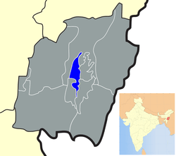
Location of Imphal West district in Manipur | |
| Coordinates: 24°49′N 93°54′E / 24.817°N 93.900°ECoordinates: 24°49′N 93°54′E / 24.817°N 93.900°E | |
| Country |
|
| State | Manipur |
| Headquarters | Lamphelpat |
| Area | |
| • Total | 519 km2 (200 sq mi) |
| Population (2011) | |
| • Total | 514,683 |
| • Density | 990/km2 (2,600/sq mi) |
| Languages | |
| • Official | Meiteilon (Manipuri) |
| Time zone | IST (UTC+5:30) |
| ISO 3166 code | IN-MN-WI |
| Vehicle registration | MN |
| Website |
imphalwest |
Imphal West district (Pron:/ˈɪmfəl or ɪmˈfɑːl/) is one of the nine districts of Manipur state in northeastern India. As of 2011 it is the most populous district in the state.[1]
Geography
Lamphelpat city is the administrative headquarters of the district. The district occupies an area of 558 km2.
Climate
| Imphal | ||||||||||||||||||||||||||||||||||||||||||||||||||||||||||||
|---|---|---|---|---|---|---|---|---|---|---|---|---|---|---|---|---|---|---|---|---|---|---|---|---|---|---|---|---|---|---|---|---|---|---|---|---|---|---|---|---|---|---|---|---|---|---|---|---|---|---|---|---|---|---|---|---|---|---|---|---|
| Climate chart (explanation) | ||||||||||||||||||||||||||||||||||||||||||||||||||||||||||||
| ||||||||||||||||||||||||||||||||||||||||||||||||||||||||||||
| ||||||||||||||||||||||||||||||||||||||||||||||||||||||||||||
Economy
The district ranks first on the basis of "District Infrastructure Index " calculated under the patronage of Ministry of North East Region(DoNER).[2]
Demographics
According to the 2011 census Imphal West district has a population of 514,683,[1] roughly equal to the nation of Cape Verde.[3] This gives it a ranking of 545th in India (out of a total of 640).[1] The district has a population density of 992 inhabitants per square kilometre (2,570/sq mi) .[1] Its population growth rate over the decade 2001-2011 was 15.82%.[1] Imphal West has a sex ratio of 1029 females for every 1000 males,[1] and a literacy rate of 86.7%.[1]
References
- 1 2 3 4 5 6 7 "District Census 2011". Census2011.co.in. 2011. Retrieved 2011-09-30.
- ↑ "District at a glance". Imphal West district website. Retrieved 19 May 2010.
- ↑ US Directorate of Intelligence. "Country Comparison:Population". Retrieved 2011-10-01.
Cape Verde 516,100 July 2011 est.
External links
 |
Senapati district | | ||
| Senapati district | |
Imphal East district | ||
| ||||
| | ||||
| Bishnupur district | Thoubal district |