Iron Duff, North Carolina
| Ironduff, North Carolina | |
|---|---|
| Populated place | |
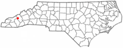 Location of Iron Duff, North Carolina | |
| Coordinates: 35°34′44″N 82°58′12″W / 35.579°N 82.970°WCoordinates: 35°34′44″N 82°58′12″W / 35.579°N 82.970°W | |
| Country | United States |
| State | North Carolina |
| County | Haywood |
| Elevation | 2,592 ft (317 m) |
| Time zone | Eastern (EST) (UTC-5) |
| • Summer (DST) | EDT (UTC-4) |
| ZIP code | 28785 |
| Area code(s) | 828 |
| GNIS feature ID | 1020894 |
Iron Duff (also Aaron Duff, or Ironduff) is an unincorporated community in Haywood County, North Carolina, United States.[1]
Geography
Iron Duff is located at latitude 35.579 and longitude -82.970 The elevation is 2,592 feet.[2]
References
- ↑ "Iron Duff, North Carolina". Geographic Names Information System. United States Geological Survey.
- ↑ "Iron Duff Populated Place Profile". NC Hometown Locator. Retrieved 2016-08-09.
Municipalities and communities of Haywood County, North Carolina, United States | ||
|---|---|---|
| Towns | 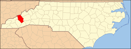 | |
| CDPs | ||
| Unincorporated communities | ||
This article is issued from Wikipedia - version of the 11/5/2016. The text is available under the Creative Commons Attribution/Share Alike but additional terms may apply for the media files.