Iroquois, West Virginia
| Iroquois | |
|---|---|
| Unincorporated community | |
 Iroquois  Iroquois Location within the state of West Virginia | |
| Coordinates: 37°34′52″N 81°20′26″W / 37.58111°N 81.34056°WCoordinates: 37°34′52″N 81°20′26″W / 37.58111°N 81.34056°W | |
| Country | United States |
| State | West Virginia |
| County | Wyoming |
| Areawas a coal camp community, with company store, and company houses.. | |
| • Water | Formatting error: invalid input when rounding sq mi (situated on banks of guyandot river km2) |
| Elevation | 1,506 ft (459 m) |
| Time zone | Eastern (EST) (UTC-5) |
| • Summer (DST) | EDT (UTC-4) |
| GNIS ID | 1554782[1] |
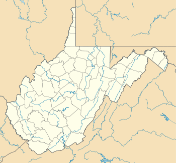
Iroquois is an unincorporated community in Wyoming County, West Virginia.
The community was named after the Iroquois Indians.[2]
References
- ↑ U.S. Geological Survey Geographic Names Information System: Iroquois, West Virginia
- ↑ Kenny, Hamill (1945). West Virginia Place Names: Their Origin and Meaning, Including the Nomenclature of the Streams and Mountains. Piedmont, WV: The Place Name Press. pp. 329–330.
Municipalities and communities of Wyoming County, West Virginia, United States | ||
|---|---|---|
| City | 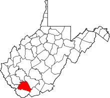 | |
| Towns | ||
| CDPs | ||
| Unincorporated communities |
| |
| Footnotes | ‡This populated place also has portions in an adjacent county or counties | |
This article is issued from Wikipedia - version of the 7/28/2016. The text is available under the Creative Commons Attribution/Share Alike but additional terms may apply for the media files.