Jammalamadugu
| Jammalamadugu జమ్మలమడుగు | |
|---|---|
| Town | |
|
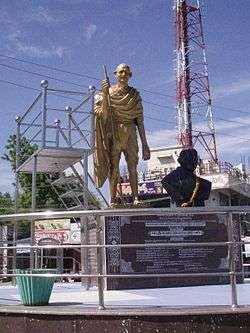
Mahatma Gandhi statue in Jammalamadugu | |
 Jammalamadugu Location in Andhra Pradesh, India | |
| Coordinates: 14°51′N 78°23′E / 14.85°N 78.38°ECoordinates: 14°51′N 78°23′E / 14.85°N 78.38°E | |
| Country | India |
| State | Andhra Pradesh |
| Region | Rayalaseema |
| District | Kadapa |
| Area[1] | |
| • Total | 24.83 km2 (9.59 sq mi) |
| Elevation[2] | 184 m (604 ft) |
| Population (2011)[3] | |
| • Total | 46,069 |
| • Density | 1,900/km2 (4,800/sq mi) |
| Languages | |
| • Official | Telugu |
| Time zone | IST (UTC+5:30) |
| PIN | 516 434 |
| Vehicle registration | AP-04 |
| Website | Jammalamadugu Municipality |
Jammalamadugu is a Municipality and Revenue Division in YSR district of the Indian state of Andhra Pradesh. It is located in Jammalamadugu mandal of Jammalamadugu revenue division.[4]
Geography
Jammalamadugu is located at 14°50′N 78°24′E / 14.83°N 78.4°E.[5] It has an average elevation of 169 metres (554 feet).
Demographics
As of 2001 India census,[6] Jammalamadugu had a population of 46,000 approximately. Males constitute 49% of the population and females 51%. Jammalamadugu has an average literacy rate of 79.5%, higher than the national average of 59.5%: male literacy is 85%, and female literacy is 74%. 11% of the population is under 6 years of age.
Transport
Yerraguntla railway station is a junction for Nandyal-Yerranguntla section. It falls under the jurisdiction of Guntakal railway division.[7]
References
- ↑ "Basic Information of Municipality". Commissioner & Director of Municipal Administration. Municipal Administration & Urban Development Department, Govt. of Andhra Pradesh. Retrieved 19 November 2014.
- ↑ "Elevation for Jammalamadugu". Veloroutes. Retrieved 12 August 2014.
- ↑ "Census 2011". The Registrar General & Census Commissioner, India. Retrieved 12 August 2014.
- ↑ "Revenue Divisions and Mandals". Official website of YSR Kadapa District. National Informatics Centre- Kadapa, Andhra Pradesh. Retrieved 23 May 2015.
- ↑ Falling Rain Genomics, Inc - Jammalamadugu
- ↑ "Census of India 2001: Data from the 2001 Census, including cities, villages and towns (Provisional)". Census Commission of India. Archived from the original on 2004-06-16. Retrieved 2008-11-01.
- ↑ "Nandyal-Yerranguntla rail line commissioned". The Hindu. 24 August 2016. Retrieved 24 August 2016.
| Wikimedia Commons has media related to Jammalamadugu. |