Javorani
| Javorani | |
|---|---|
|
| |
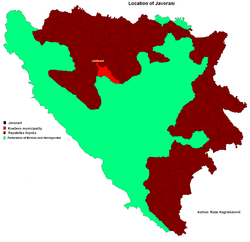 Location of Javorani in Bosnia and Herzegovina | |
| Coordinates: 44°37′N 17°15′E / 44.617°N 17.250°ECoordinates: 44°37′N 17°15′E / 44.617°N 17.250°E | |
| Country | Bosnia and Herzegovina |
| Division | Republika Srpska |
| Municipality | Kneževo |
| Government | |
| • Local community president | Brane Tubić (SNSD) |
| Area | |
| • Total | 25 km2 (10 sq mi) |
| Population (1991) | |
| • Total | 1,289 |
| Time zone | EET (UTC+2) |
| • Summer (DST) | EEST (UTC+3) |
| Postal code | 78233 |
| Area code(s) | (+387) 51 |
Javorani (Cyrillic: Јаворани), is a village in Kneževo (Skender Vakuf) municipality, near Banja Luka, Republika Srpska, Bosnia and Herzegovina.
Population
Ethnic composition, 1991 census
| Ethnic composition of Skender Vakuf municipality, by settlements, 1991. census | ||||||
| settlement | total | Serbs | Croats | Muslims | Yugoslavs | others |
| Javorani | 1,289 | 1,273 | 1 | 0 | 6 | 9 |
References
- Official results from the book: Ethnic composition of Bosnia-Herzegovina population, by municipalities and settlements, 1991. census, Zavod za statistiku Bosne i Hercegovine - Bilten no.234, Sarajevo 1991.
Gallery
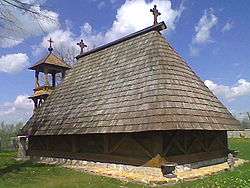
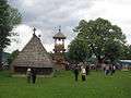 Old St. Nicholas Church from 1757.
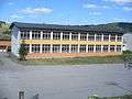 New Primary school in Javorani.
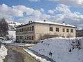 Old Primary school in Javorani.
.jpg) Mountain Tisovac.
Mountain Tisovac.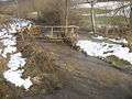 River Kotlovac.
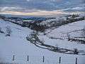 Winter in Javorani.
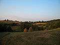 Landscape in Javorani.
People from Javorani
- Lazo Tešanović - One of the Chetniks leader in Bosnia during World War II.
See also
External links
| Wikimedia Commons has media related to Javorani. |
This article is issued from Wikipedia - version of the 1/22/2016. The text is available under the Creative Commons Attribution/Share Alike but additional terms may apply for the media files.