Josipdol, Ribnica na Pohorju
| Josipdol | |
|---|---|
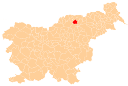
 Josipdol Location in Slovenia | |
| Coordinates: 46°31′57.13″N 15°17′23.79″E / 46.5325361°N 15.2899417°ECoordinates: 46°31′57.13″N 15°17′23.79″E / 46.5325361°N 15.2899417°E | |
| Country |
|
| Traditional region | Styria |
| Statistical region | Carinthia |
| Municipality | Ribnica na Pohorju |
| Area | |
| • Total | 3.55 km2 (1.37 sq mi) |
| Elevation | 609.1 m (1,998.4 ft) |
| Population (2002) | |
| • Total | 330 |
| Climate | Dfb |
| [1] | |
Josipdol (pronounced [ˈjoːsipdɔl]) is a settlement in the Municipality of Ribnica na Pohorju in northeastern Slovenia. It lies in the Pohorje Hills in the upper valley of a small right tributary of the Drava River. Traditionally the area was part of Styria. It is now included in the Carinthia Statistical Region.[2]
A quarry of local tonalite rock operates south of the settlement.
References
External links
| Settlements | Administrative centre: Ribnica na Pohorju
|  |
|---|---|---|
| Landmarks |
| |
This article is issued from Wikipedia - version of the 7/12/2016. The text is available under the Creative Commons Attribution/Share Alike but additional terms may apply for the media files.