Kaolinovo Municipality
| Kaolinovo Municipality Община Каолиново | |
|---|---|
| Municipality | |
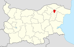 Kaolinovo Municipality within Bulgaria and Shumen Province. | |
| Coordinates: 43°35′N 27°5′E / 43.583°N 27.083°ECoordinates: 43°35′N 27°5′E / 43.583°N 27.083°E | |
| Country |
|
| Province (Oblast) | Shumen |
| Admin. centre (Obshtinski tsentar) | Kaolinovo |
| Area | |
| • Total | 293 km2 (113 sq mi) |
| Population (December 2009)[1] | |
| • Total | 12,251 |
| Time zone | EET (UTC+2) |
| • Summer (DST) | EEST (UTC+3) |
Kaolinovo Municipality (Bulgarian: Община Каолиново) is a municipality (obshtina) in Shumen Province, Northeastern Bulgaria, located in the Ludogorie geographical region, part of the Danubian Plain. It is named after its administrative centre - the town of Kaolinovo.
The municipality embraces a territory of 293 km² with a population of 12,251 inhabitants, as of December 2009.[1]
Settlements
.png)
Kaspichan
Novi Pazar
Veliki Preslav
Smyadovo
Varbitsa
Hitrino
Venets
Nikola Kozlevo
Kaolinovo Municipality within Shumen Province
Kaolinovo Municipality includes the following 16 places (towns are shown in bold):
| Town/Village | Cyrillic | Population[2][3][4] (December 2009) |
|---|---|---|
| Kaolinovo | Каолиново | 1,538 |
| Branichevo | Браничево | 1,220 |
| Doyrantsi | Дойранци | 535 |
| Dolina | Долина | 503 |
| Gusla | Гусла | 664 |
| Kliment | Климент | 1019 |
| Lisi Vrah | Лиси връх | 69 |
| Lyatno | Лятно | 584 |
| Naum | Наум | 433 |
| Omarchevo | Омарчево | 38 |
| Pristoe | Пристое | 983 |
| Sini Vir | Сини вир | 604 |
| Sredkovets | Средковец | 642 |
| Todor Ikonomovo | Тодор Икономово | 2,027 |
| Takach | Тъкач | 718 |
| Zagoriche | Загориче | 674 |
| Total | 12,251 |
Demography
The following table shows the change of the population during the last four decades.
| Kaolinovo Municipality | ||||||||
|---|---|---|---|---|---|---|---|---|
| Year | 1975 | 1985 | 1992 | 2001 | 2005 | 2007 | 2009 | 2011 |
| Population | 20,916 | 19,382 | 13,556 | 12,544 | 12,518 | 12,456 | 12,251 | 12,093 |
| Sources: Census 2001,[5] Census 2011,[6] „pop-stat.mashke.org“,[7] | ||||||||
Ethnic composition
According to the 2011 census, among those who answered the optional question on ethnic identification, the ethnic composition of the municipality was the following:
| Ethnic group | Population | Percentage |
|---|---|---|
| Bulgarians | 722 | 6.3% |
| Turks | 8964 | 77.6% |
| Roma (Gypsy) | 1675 | 14.5% |
| Other | 12 | 0.1% |
| Undeclared | 175 | 1.5% |
See also
References
- 1 2 (English) Bulgarian National Statistical Institute - Bulgarian provinces and municipalities in 2009
- ↑ (English) Bulgarian National Statistical Institute - Bulgarian towns in 2009
- ↑ (English) Bulgarian National Statistical Institute - Bulgarian villages under 1000 inhabitants - December 2009
- ↑ (English) Bulgarian National Statistical Institute - Bulgarian Settlements 1000-5000 inhabitants - December 2009
- ↑ National Statistical Institute - Census 2001
- ↑ Population by province, municipality, settlement and age by 01.02.2011; Bulgarian National Statistical Institute
- ↑ Population of Bulgarian divisions
- ↑ Population by province, municipality, settlement and ethnic identification, by 01.02.2011; Bulgarian National Statistical Institute (Bulgarian)
External links
- Official website (Bulgarian)
This article is issued from Wikipedia - version of the 11/3/2013. The text is available under the Creative Commons Attribution/Share Alike but additional terms may apply for the media files.