Kata, Burma
| Kata | |
|---|---|
|
The Ayeyarwady River at Kata. | |
 Kata Location in Burma | |
| Coordinates: 26°3′0″N 97°25′0″E / 26.05000°N 97.41667°ECoordinates: 26°3′0″N 97°25′0″E / 26.05000°N 97.41667°E | |
| Country |
|
| State | Kachin State |
| Population | |
| • Religions | Buddhism |
| Time zone | MST (UTC+6.30) |
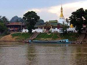
Kata or Khata is a town in Kachin State, Burma. It lies on the Ayeyarwady River.
| Wikimedia Commons has media related to Khata. |
Capital: Myitkyina | ||
| Bhamo District |  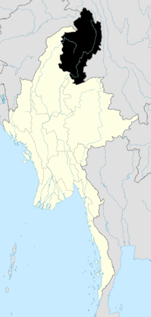 | |
| Mohnyin District | ||
| Myitkyina District | ||
| Putao District | ||
| Main cities and towns | ||
This article is issued from Wikipedia - version of the 3/29/2014. The text is available under the Creative Commons Attribution/Share Alike but additional terms may apply for the media files.