Kimcote and Walton
| Kimcote and Walton | |
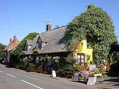 Farm shop in Walton |
|
 Kimcote and Walton |
|
| Population | 600 (2011) |
|---|---|
| OS grid reference | SP589866 |
| Civil parish | Kimcote and Walton |
| District | Harborough |
| Shire county | Leicestershire |
| Region | East Midlands |
| Country | England |
| Sovereign state | United Kingdom |
| Post town | LEICESTER |
| Postcode district | LE17 |
| Police | Leicestershire |
| Fire | Leicestershire |
| Ambulance | East Midlands |
| EU Parliament | East Midlands |
| UK Parliament | Harborough |
|
|
Coordinates: 52°28′28″N 1°07′59″W / 52.47436°N 1.13313°W
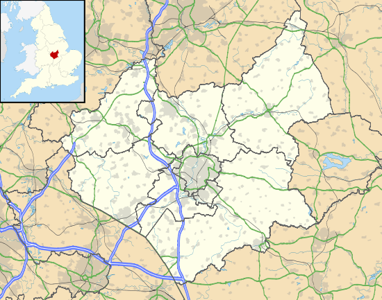
Kimcote and Walton is a parish situated in Leicestershire, approximately 4 miles north east of Lutterworth. The population of the civil parish at the 2011 census was 600.[1] The parish includes the villages of Kimcote and Walton (historically also known as Walton in Knaptoft). All Saints Parish Church is situated in Kimcote. Walton once had a church but it was defunct in about 1630. Walton still has a Baptist Chapel and a Public House, the Dog and Gun.
The parish was created in 1898 from the merger of the civil parishes on Kimcote and Walton in Knaptoft.[2]
The parish was the base for many stockingers[3] during the 19th century.
References
- ↑ "Civil Parish 2011". Neighbourhood Statistics. Office for National Statistics. Retrieved 15 June 2016.
- ↑ "Kimcote and Walton CP through time | Census tables with data for the Parish-level Unit | Vision of Britain website". visionofbritain.org.uk. Retrieved 4 August 2016.
- ↑ "www.leicestershirevillages.com/uploads/frameworkknitting.doc". leicestershirevillages.com. Retrieved 4 August 2016.
External links
- Census 2001 Parish Profile
- Parish Council
- Ordnance Survey mapping of Kimcote and Walton
- Heritage records in Kimcote and Walton
- Photographs of Kimcote from Geograph
- Photographs of Walton from Geograph
- The Grange - Bed and Breakfast accommodation
![]() Media related to Kimcote and Walton at Wikimedia Commons
Media related to Kimcote and Walton at Wikimedia Commons