Kollumerland en Nieuwkruisland
| Kollumerland en Nieuwkruisland Kollumerland c.a. | |||
|---|---|---|---|
| Municipality | |||
|
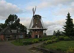
Windmill Rust Roest | |||
| |||
.svg.png) Location in Friesland | |||
| Coordinates: 53°17′N 6°8′E / 53.283°N 6.133°ECoordinates: 53°17′N 6°8′E / 53.283°N 6.133°E | |||
| Country | Netherlands | ||
| Province | Friesland | ||
| Government[1] | |||
| • Body | Municipal council | ||
| • Mayor | Bearn Bilker (CDA) | ||
| Area[2] | |||
| • Total | 116.35 km2 (44.92 sq mi) | ||
| • Land | 109.75 km2 (42.37 sq mi) | ||
| • Water | 6.60 km2 (2.55 sq mi) | ||
| Elevation[3] | 1 m (3 ft) | ||
| Population (May 2014)[4] | |||
| • Total | 12,905 | ||
| • Density | 118/km2 (310/sq mi) | ||
| Time zone | CET (UTC+1) | ||
| • Summer (DST) | CEST (UTC+2) | ||
| Postcode | 9291–9299, 9851–9853 | ||
| Area code | 0511, 0594 | ||
| Website |
www | ||


Kollumerland en Nieuwkruisland (![]() pronunciation , officially abbreviated as Kollumerland c.a. ("c.a." means cum annexis, "with annex"), West Frisian: Kollumerlân, Gronings: Kölmerlaand) is a municipality in the northern Netherlands, in the province of Friesland.
pronunciation , officially abbreviated as Kollumerland c.a. ("c.a." means cum annexis, "with annex"), West Frisian: Kollumerlân, Gronings: Kölmerlaand) is a municipality in the northern Netherlands, in the province of Friesland.
Population centres
Augsbuurt, Burum, Kollum, Kollumerpomp, Kollumerzwaag, Munnekezijl, Oudwoude, Triemen, Veenklooster, Warfstermolen, Westergeest and Zwagerbosch.[5]
Kollumerland en Nieuwkruisland has a population of 12,775 (1 april 2016, source: CBS).[6]
Topography
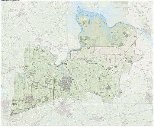
Dutch Topographic map of the municipality of Kollumerland en Nieuwkruisland, June 2015.
Government
The Burum community houses the satellite ground station of the Nationale SIGINT Organisatie.[7]
References
- ↑ "Burgemeester Bearn Bilker" [Mayor Bearn Bilker] (in Dutch). Gemeente Kollumerland c.a. Retrieved 16 September 2013.
- ↑ "Kerncijfers wijken en buurten" [Key figures for neighbourhoods]. CBS Statline (in Dutch). CBS. 2 July 2013. Retrieved 12 March 2014.
- ↑ "Postcodetool for 9291KB". Actueel Hoogtebestand Nederland (in Dutch). Het Waterschapshuis. Retrieved 16 September 2013.
- ↑ "Bevolkingsontwikkeling; regio per maand" [Population growth; regions per month]. CBS Statline (in Dutch). CBS. 26 June 2014. Retrieved 24 July 2014.
- ↑ http://www.kollumerland.nl/gemeente/gemeente_3721/item/feiten-cijfers-2016_6145.html
- ↑ "CBS StatLine - Bevolkingsontwikkeling; regio per maand". statline.cbs.nl. Retrieved 2016-06-20.
- ↑ "Nationale SIGINT Organisatie." (Archived 2013-06-13 at WebCite) Ministry of Defence. Retrieved on 13 June 2013.
External links
 Media related to Kollumerland en Nieuwkruisland at Wikimedia Commons
- Official website
 |
Dongeradeel | Lauwersmeer | De Marne (GR) | |
| Dantumadiel | |
Zuidhorn (GR) | ||
| ||||
| | ||||
| Achtkarspelen |

This article is issued from Wikipedia - version of the 11/19/2016. The text is available under the Creative Commons Attribution/Share Alike but additional terms may apply for the media files.