Neraida, Trikala
For the village in Kozani regional unit, see Neraida, Kozani.
| Neraida Νεράιδα | |
|---|---|
 Neraida | |
|
Location within the regional unit 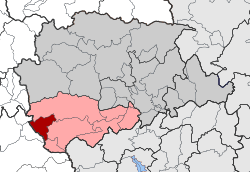 | |
| Coordinates: 39°27′N 21°14′E / 39.450°N 21.233°ECoordinates: 39°27′N 21°14′E / 39.450°N 21.233°E | |
| Country | Greece |
| Administrative region | Thessaly |
| Regional unit | Trikala |
| Municipality | Pyli |
| • Municipal unit | 58.9 km2 (22.7 sq mi) |
| Elevation | 920 m (3,020 ft) |
| Population (2011)[1] | |
| • Municipal unit | 252 |
| • Municipal unit density | 4.3/km2 (11/sq mi) |
| Community[1] | |
| • Population | 78 (2011) |
| Time zone | EET (UTC+2) |
| • Summer (DST) | EEST (UTC+3) |
| Vehicle registration | ΤΚ |
Neraida (Greek: Νεράιδα) is a village and a former community in the Trikala regional unit, Thessaly, Greece. Since the 2011 local government reform it is part of the municipality Pyli, of which it is a municipal unit.[2] The municipal unit has an area of 58.888 km2.[3]
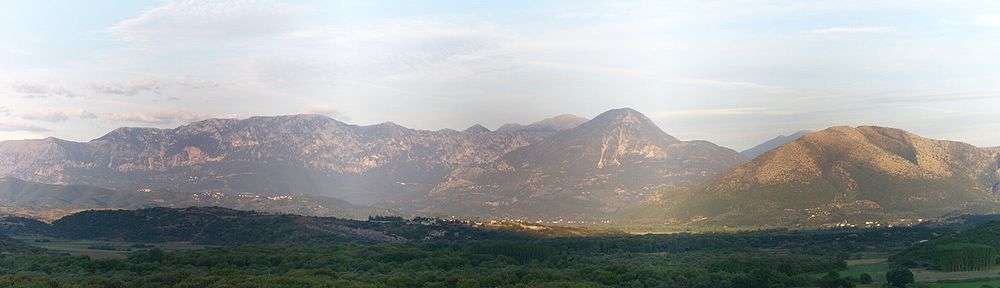
Neraida (foreground, middle) before the mountain Gorillas
References
- 1 2 "Απογραφή Πληθυσμού - Κατοικιών 2011. ΜΟΝΙΜΟΣ Πληθυσμός" (in Greek). Hellenic Statistical Authority.
- ↑ Kallikratis law Greece Ministry of Interior (Greek)
- ↑ "Population & housing census 2001 (incl. area and average elevation)" (PDF) (in Greek). National Statistical Service of Greece.
This article is issued from Wikipedia - version of the 12/2/2016. The text is available under the Creative Commons Attribution/Share Alike but additional terms may apply for the media files.