Kuboes
| Kuboes | |
|---|---|
|
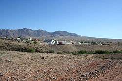
Old mission church in Kuboes | |
 Kuboes  Kuboes  Kuboes
| |
| Coordinates: 28°26′49.2″S 16°59′20.76″E / 28.447000°S 16.9891000°ECoordinates: 28°26′49.2″S 16°59′20.76″E / 28.447000°S 16.9891000°E | |
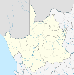
| Country | South Africa |
| Province | Northern Cape |
| District | Namakwa |
| Municipality | Richtersveld |
| Area[1] | |
| • Total | 0.88 km2 (0.34 sq mi) |
| Population (2011)[1] | |
| • Total | 948 |
| • Density | 1,100/km2 (2,800/sq mi) |
| Racial makeup (2011)[1] | |
| • Black African | 0.6% |
| • Coloured | 95.5% |
| • Indian/Asian | 0.2% |
| • Other | 3.7% |
| First languages (2011)[1] | |
| • Afrikaans | 96.5% |
| • English | 1.3% |
| • Other | 2.2% |
| PO box | 8292 |
Kuboes is a town in Richtersveld Local Municipality in the Northern Cape province of South Africa.
Kuboes was one of the first permanent settlements on the Richtersveld. The town grew around a Rhenish mission set up by revered Johan Hein, who began to preach to the nomadic population of the surrounding areas in 1844. A church was built in 1893, and eventually the itinerant population decided to set up in Kuboes itself.[2]
Kuboes is a centre of Nama culture, and the local school is claimed to be the only school in the world that teaches the Nama language.[2]
References
Municipalities and communities of Namakwa District Municipality, Northern Cape | ||
|---|---|---|
District seat: Springbok | ||
| Hantam | .svg.png) | |
| Kamiesberg | ||
| Karoo Hoogland | ||
| Khâi-Ma | ||
| Nama Khoi | ||
| Richtersveld | ||
This article is issued from Wikipedia - version of the 8/18/2014. The text is available under the Creative Commons Attribution/Share Alike but additional terms may apply for the media files.