Kumenan, Okayama
| Kumenan 久米南町 | |
|---|---|
| Town | |
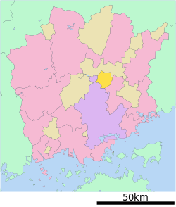 Location of Kumenan in Okayama Prefecture | |
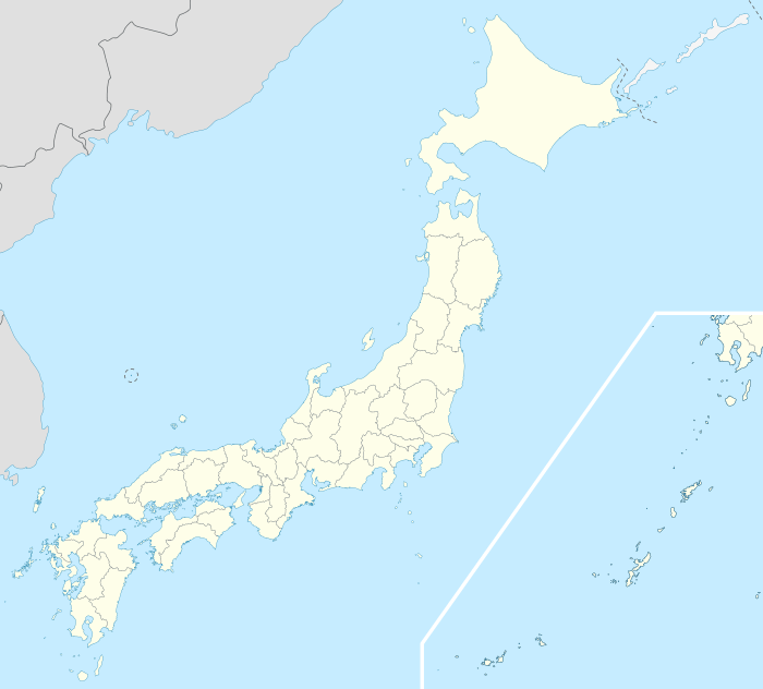 Kumenan Location in Japan | |
| Coordinates: 34°56′N 133°58′E / 34.933°N 133.967°ECoordinates: 34°56′N 133°58′E / 34.933°N 133.967°E | |
| Country | Japan |
| Region |
Chūgoku San'yō |
| Prefecture | Okayama Prefecture |
| District | Kume |
| Area | |
| • Total | 78.60 km2 (30.35 sq mi) |
| Population (2003) | |
| • Total | 5,881 |
| • Density | 75/km2 (190/sq mi) |
| Time zone | Japan Standard Time (UTC+9) |
| Website |
www |
Kumenan (久米南町 Kumenan-chō) is a town located in Kume District, Okayama Prefecture, Japan.
As of 2003, the town has an estimated population of 5,881 and a density of 74.82 persons per km². The total area is 78.60 km².
External links
 Media related to Kumenan, Okayama at Wikimedia Commons
- Town of Kumenan (Japanese)
 Kumenan travel guide from Wikivoyage
This article is issued from Wikipedia - version of the 11/8/2015. The text is available under the Creative Commons Attribution/Share Alike but additional terms may apply for the media files.