Kunhegyes
| Kunhegyes | |
|---|---|
 Kunhegyes | |
| Coordinates: 47°22′12″N 20°37′51″E / 47.37000°N 20.63083°ECoordinates: 47°22′12″N 20°37′51″E / 47.37000°N 20.63083°E | |
| Country |
|
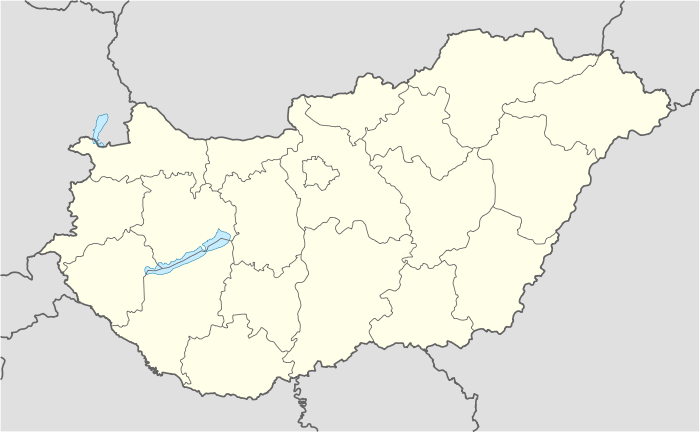
| County | Jász-Nagykun-Szolnok |
| District | Kunhegyes (seat) |
| Area | |
| • Total | 148.94 km2 (57.51 sq mi) |
| Population (2001) | |
| • Total | 8,601 |
| • Density | 57.7/km2 (149/sq mi) |
| Time zone | CET (UTC+1) |
| • Summer (DST) | CEST (UTC+2) |
| Postal code | 5340 |
| Area code(s) | 59 |
Kunhegyes is a town in Jász-Nagykun-Szolnok, Hungary. It is located at around 47°22′12″N 20°37′51″E / 47.37000°N 20.63083°E.
International relations
 Baia Sprie (Felsőbánya), Romania; since 2006
 Feketić (Bácsfeketehegy), Serbia; since 1993
- Mali Iđoš (Kishegyes), Serbia; since 2001
 Siegen, Germany; since 2001
 Szerzyny, Poland; since 2003
- Tășnad, Romania
References
External links
- Official site in Hungarian
| Cities and towns |  | |
|---|---|---|
| Villages |
| |
| Other topics |
| |
This article is issued from Wikipedia - version of the 10/19/2016. The text is available under the Creative Commons Attribution/Share Alike but additional terms may apply for the media files.