Kurukabaru Airport
| Kurukabaru Airport | |||||||||||
|---|---|---|---|---|---|---|---|---|---|---|---|
| IATA: none – ICAO: SYKK | |||||||||||
| Summary | |||||||||||
| Serves | Kurukabaru | ||||||||||
| Elevation AMSL | 3,198 ft / 975 m | ||||||||||
| Coordinates | 4°42′50″N 59°54′40″W / 4.71389°N 59.91111°WCoordinates: 4°42′50″N 59°54′40″W / 4.71389°N 59.91111°W | ||||||||||
| Map | |||||||||||
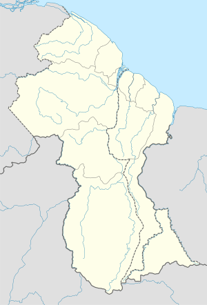 SYKK Location in Guyana | |||||||||||
| Runways | |||||||||||
| |||||||||||
Kurukabaru Airport (IATA: SYKK) is an airport serving the village of Kurukabaru, in the Potaro-Siparuni Region of Guyana.
See also
 Guyana portal
 Aviation portal
- List of airports in Guyana
- Transport in Guyana
References
External links
- Bing Maps - Kurukabaru
- Kurukabaru Airport
- OurAirports - Kurukabaru
- Airport information for SYKK at Great Circle Mapper.
This article is issued from Wikipedia - version of the 5/30/2016. The text is available under the Creative Commons Attribution/Share Alike but additional terms may apply for the media files.