Lüderitz Airport
| Lüderitz Airport | |||||||||||||||
|---|---|---|---|---|---|---|---|---|---|---|---|---|---|---|---|
 | |||||||||||||||
| IATA: LUD – ICAO: FYLZ | |||||||||||||||
| Summary | |||||||||||||||
| Airport type | Public | ||||||||||||||
| Owner/Operator | Namibia Airports Co. | ||||||||||||||
| Serves | Lüderitz, Namibia | ||||||||||||||
| Elevation AMSL | 457 ft / 139 m | ||||||||||||||
| Coordinates | 26°41′15″S 15°14′35″E / 26.68750°S 15.24306°ECoordinates: 26°41′15″S 15°14′35″E / 26.68750°S 15.24306°E | ||||||||||||||
| Map | |||||||||||||||
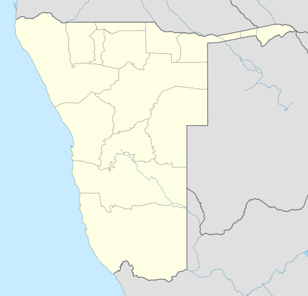 FYLZ Location in Namibia | |||||||||||||||
| Runways | |||||||||||||||
| |||||||||||||||
| Statistics (2006) | |||||||||||||||
| |||||||||||||||
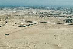
Lüderitz Airport (IATA: LUD, ICAO: FYLZ) is an airport serving Lüderitz, a town in the ǁKaras Region of Namibia. The airport is about 9 km (6 mi) southeast of the center of Lüderitz, on the B4 road.[4]
Airlines and destinations
| Airlines | Destinations |
|---|---|
| Air Namibia | Oranjemund, Windhoek-Hosea Kutako |
See also
 Aviation portal
 Namibia portal
- List of airports in Namibia
- Transport in Namibia
References
- ↑ Namibia Airports Co.
- ↑ Airport information for FYLZ from DAFIF (effective October 2006)
- ↑ Airport information for LUD at Great Circle Mapper.
- ↑ "Distance from Lüderitz to airport". WikiMapia. Retrieved 18 Feb 2010.
External links
- Current weather for Luderitz / Diaz Point, Namibia (FYLZ) at NOAA/NWS
- OurAirports - Luderitz
- OpenStreetMap - Luderitz
This article is issued from Wikipedia - version of the 12/4/2016. The text is available under the Creative Commons Attribution/Share Alike but additional terms may apply for the media files.