Landes-le-Gaulois
| Landes-le-Gaulois | |
|---|---|
|
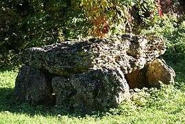
Dolmen | |
 Landes-le-Gaulois | |
|
Location within Centre-Val de Loire region  Landes-le-Gaulois | |
| Coordinates: 47°39′12″N 1°11′02″E / 47.6533°N 1.1839°ECoordinates: 47°39′12″N 1°11′02″E / 47.6533°N 1.1839°E | |
| Country | France |
| Region | Centre-Val de Loire |
| Department | Loir-et-Cher |
| Arrondissement | Blois |
| Canton | Herbault |
| Intercommunality | Beauce - Val de Cisse |
| Government | |
| • Mayor (2014–2020) | Didier Guillon |
| Area1 | 24.15 km2 (9.32 sq mi) |
| Population (2013)2 | 729 |
| • Density | 30/km2 (78/sq mi) |
| Time zone | CET (UTC+1) |
| • Summer (DST) | CEST (UTC+2) |
| INSEE/Postal code | 41109 / 41190 |
| Elevation |
97–128 m (318–420 ft) (avg. 105 m or 344 ft) |
|
1 French Land Register data, which excludes lakes, ponds, glaciers > 1 km² (0.386 sq mi or 247 acres) and river estuaries. 2 Population without double counting: residents of multiple communes (e.g., students and military personnel) only counted once. | |
Landes-le-Gaulois is a commune in the Loir-et-Cher department of central France.
Population
| Historical population | ||
|---|---|---|
| Year | Pop. | ±% |
| 1793 | 697 | — |
| 1806 | 746 | +7.0% |
| 1821 | 781 | +4.7% |
| 1831 | 810 | +3.7% |
| 1841 | 880 | +8.6% |
| 1851 | 902 | +2.5% |
| 1861 | 815 | −9.6% |
| 1872 | 862 | +5.8% |
| 1881 | 803 | −6.8% |
| 1891 | 769 | −4.2% |
| 1901 | 731 | −4.9% |
| 1911 | 735 | +0.5% |
| 1921 | 716 | −2.6% |
| 1931 | 706 | −1.4% |
| 1946 | 704 | −0.3% |
| 1954 | 697 | −1.0% |
| 1962 | 654 | −6.2% |
| 1968 | 596 | −8.9% |
| 1975 | 586 | −1.7% |
| 1982 | 568 | −3.1% |
| 1990 | 589 | +3.7% |
| 1999 | 582 | −1.2% |
| 2008 | 669 | +14.9% |
| 2013 | 729 | +9.0% |
See also
References
| Wikimedia Commons has media related to Landes-le-Gaulois. |
This article is issued from Wikipedia - version of the 11/30/2016. The text is available under the Creative Commons Attribution/Share Alike but additional terms may apply for the media files.