Klösterle, Austria
| Klösterle | ||
|---|---|---|
 | ||
| ||
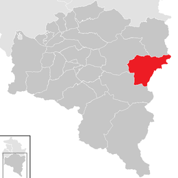
 Klösterle Location within Austria | ||
Location in the district
| ||
| Coordinates: 47°07′51″N 10°05′19″E / 47.13083°N 10.08861°ECoordinates: 47°07′51″N 10°05′19″E / 47.13083°N 10.08861°E | ||
| Country | Austria | |
| State | Vorarlberg | |
| District | Bludenz | |
| Government | ||
| • Mayor | Florian Morscher | |
| Area | ||
| • Total | 62.31 km2 (24.06 sq mi) | |
| Elevation | 1,073 m (3,520 ft) | |
| Population (1 January 2016)[1] | ||
| • Total | 662 | |
| • Density | 11/km2 (28/sq mi) | |
| Time zone | CET (UTC+1) | |
| • Summer (DST) | CEST (UTC+2) | |
| Postal code | 6754 | |
| Area code | 05582 | |
| Vehicle registration | BZ | |
| Website | www.kloesterle.at | |

Klösterle (High Alemannic: Klooschter) is a municipality in the district of Bludenz in the Austrian state of Vorarlberg.
Population
| Historical population | ||
|---|---|---|
| Year | Pop. | ±% |
| 1869 | 526 | — |
| 1880 | 1,064 | +102.3% |
| 1890 | 630 | −40.8% |
| 1900 | 703 | +11.6% |
| 1910 | 721 | +2.6% |
| 1923 | 764 | +6.0% |
| 1934 | 712 | −6.8% |
| 1939 | 721 | +1.3% |
| 1951 | 793 | +10.0% |
| 1961 | 799 | +0.8% |
| 1971 | 860 | +7.6% |
| 1981 | 782 | −9.1% |
| 1991 | 747 | −4.5% |
| 2001 | 767 | +2.7% |
| 2011 | 684 | −10.8% |
See also
References
| Wikimedia Commons has media related to Klösterle. |
This article is issued from Wikipedia - version of the 11/11/2016. The text is available under the Creative Commons Attribution/Share Alike but additional terms may apply for the media files.