Le Blanc, Louisiana
| Le Blanc, Louisiana | |
|---|---|
| Unincorporated community | |
 Le Blanc, Louisiana  Le Blanc, Louisiana | |
| Coordinates: 30°30′33″N 92°56′57″W / 30.50917°N 92.94917°WCoordinates: 30°30′33″N 92°56′57″W / 30.50917°N 92.94917°W | |
| Country | United States |
| State | Louisiana |
| Parish | Allen |
| Elevation | 46 ft (14 m) |
| Time zone | Central (CST) (UTC-6) |
| • Summer (DST) | CDT (UTC-5) |
| ZIP code | 70651 |
| Area code(s) | 337 |
| GNIS feature ID | 536367[1] |
Le Blanc is an unincorporated community in Allen Parish, Louisiana, United States. The community is located along U.S. Route 190 6 miles (9.7 km) west-northwest of Kinder. Le Blanc has a post office with ZIP code 70651, which opened on December 20, 1899.[2][3]
References
- ↑ "Le Blanc". Geographic Names Information System. United States Geological Survey.
- ↑ United States Postal Service. "USPS - Look Up a ZIP Code". Retrieved February 20, 2015.
- ↑ "Postmaster Finder - Post Offices by ZIP Code". United States Postal Service. Retrieved February 20, 2015.
Municipalities and communities of Allen Parish, Louisiana, United States | ||
|---|---|---|
| City | 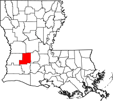 | |
| Towns | ||
| Village | ||
| Unincorporated Communities | ||
| Footnotes | ‡This populated place also has portions in an adjacent county or counties | |
This article is issued from Wikipedia - version of the 7/31/2016. The text is available under the Creative Commons Attribution/Share Alike but additional terms may apply for the media files.