Le Haut-Richelieu Regional County Municipality
| Le Haut-Richelieu | |
|---|---|
| Regional county municipality | |
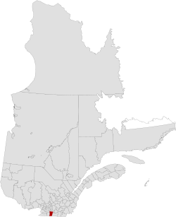 Location in province of Quebec. | |
| Coordinates: 45°12′N 73°14′W / 45.200°N 73.233°WCoordinates: 45°12′N 73°14′W / 45.200°N 73.233°W[1] | |
| Country |
|
| Province |
|
| Region | Montérégie |
| Effective | January 1, 1982 |
| County seat | Saint-Jean-sur-Richelieu |
| Government[2] | |
| • Type | Prefecture |
| • Prefect | Gilles Dolbec |
| Area[2][3] | |
| • Total | 999.70 km2 (385.99 sq mi) |
| • Land | 936.26 km2 (361.49 sq mi) |
| Population (2011)[3] | |
| • Total | 114,344 |
| • Density | 122.1/km2 (316/sq mi) |
| • Pop 2006-2011 |
|
| • Dwellings | 50,665 |
| Time zone | EST (UTC−5) |
| • Summer (DST) | EDT (UTC−4) |
| Area code(s) | 450 and 579 |
| Website |
www |
Le Haut-Richelieu (Upper Richelieu) is a regional county municipality in the Montérégie region in southwestern Quebec, Canada. Its seat is in Saint-Jean-sur-Richelieu. It is named for the Richelieu River which runs south-north through it.
Subdivisions
There are 14 subdivisions within the RCM:[2]
|
|
|
Demographics
Population
| Canada census – Le Haut-Richelieu Regional County Municipality community profile | |||
|---|---|---|---|
| 2011 | 2006 | 2001 | |
| Population: | 114,344 (+5.0% from 2006) | 108,892 (+8.1% from 2001) | 100,753 (+3.3% from 1996) |
| Land area: | 936.26 km2 (361.49 sq mi) | 936.26 km2 (361.49 sq mi) | 936.86 km2 (361.72 sq mi) |
| Population density: | 122.1/km2 (316/sq mi) | 116.3/km2 (301/sq mi) | 107.5/km2 (278/sq mi) |
| Median age: | 41.6 (M: 40.7, F: 42.6) | 40.6 (M: 39.8, F: 41.3) | 38.3 (M: 37.5, F: 39.1) |
| Total private dwellings: | 50,665 | 47,690 | 43,617 |
| Median household income: | $55,167 | $48,074 | $40,536 |
| References: 2011[3] 2006[4] 2001[5] | |||
| Historical Census Data - Le Haut-Richelieu Regional County Municipality, Quebec[6] | ||||||||||||||||||||||||||
|---|---|---|---|---|---|---|---|---|---|---|---|---|---|---|---|---|---|---|---|---|---|---|---|---|---|---|
|
|
| ||||||||||||||||||||||||
Language
| Canada Census Mother Tongue - Le Haut-Richelieu Regional County Municipality, Quebec[6] | ||||||||||||||||||
|---|---|---|---|---|---|---|---|---|---|---|---|---|---|---|---|---|---|---|
| Census | Total | French |
English |
French & English |
Other | |||||||||||||
| Year | Responses | Count | Trend | Pop % | Count | Trend | Pop % | Count | Trend | Pop % | Count | Trend | Pop % | |||||
| 2011 |
113,245 |
106,260 | |
93.83% | 3,875 | |
3.42% | 980 | |
0.87% | 2,130 | |
1.88% | |||||
| 2006 |
107,390 |
100,475 | |
93.56% | 3,355 | |
3.12% | 695 | |
0.65% | 2,865 | |
2.67% | |||||
| 2001 |
99,630 |
93,170 | |
93.52% | 3,750 | |
3.76% | 730 | |
0.73% | 1,980 | |
1.99% | |||||
| 1996 |
96,475 |
90,585 | n/a | 93.89% | 3,660 | n/a | 3.79% | 785 | n/a | 0.81% | 1,445 | n/a | 1.50% | |||||
Transportation
Access Routes
Highways and numbered routes that run through the municipality, including external routes that start or finish at the county border:[7]
|
See also
References
- ↑ Reference number 141078 of the Commission de toponymie du Québec (French)
- 1 2 3 Geographic code 560 in the official Répertoire des municipalités (French)
- 1 2 3 "(Code 2456) Census Profile". 2011 census. Statistics Canada. 2012.
- ↑ "2006 Community Profiles". Canada 2006 Census. Statistics Canada. March 30, 2011. Retrieved 2014-02-08.
- ↑ "2001 Community Profiles". Canada 2001 Census. Statistics Canada. February 17, 2012. Retrieved 2014-02-08.
- 1 2 Statistics Canada: 1996, 2001, 2006, 2011 census
- ↑ Official Transport Quebec Road Map
 |
Roussillon RCM | La Vallée-du-Richelieu RCM / Rouville RCM | | |
| Les Jardins-de-Napierville RCM | |
Brome-Missisquoi RCM | ||
| ||||
| | ||||
| |
|
This article is issued from Wikipedia - version of the 4/11/2014. The text is available under the Creative Commons Attribution/Share Alike but additional terms may apply for the media files.