Lemsterland
| Lemsterland Lemsterlân | |||
|---|---|---|---|
| Former municipality | |||
|
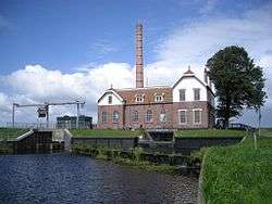
Pumping station in Echten | |||
| |||
.svg.png) Location in Friesland | |||
| Coordinates: 52°51′N 5°43′E / 52.850°N 5.717°ECoordinates: 52°51′N 5°43′E / 52.850°N 5.717°E | |||
| Country | Netherlands | ||
| Province | Friesland | ||
| Dissolved | 1 January 2014[1] | ||
| Area[2] | |||
| • Total | 124.34 km2 (48.01 sq mi) | ||
| • Land | 75.93 km2 (29.32 sq mi) | ||
| • Water | 48.41 km2 (18.69 sq mi) | ||
| Elevation[3] | 0 m (0 ft) | ||
| Population (November 2013)[4] | |||
| • Total | 13,544 | ||
| • Density | 178/km2 (460/sq mi) | ||
| Time zone | CET (UTC+1) | ||
| • Summer (DST) | CEST (UTC+2) | ||
| Postcode | 8508, 8530–8539 | ||
| Area code | 0514 | ||


Lemsterland (![]() pronunciation , West Frisian: Lemsterlân) is a former municipality in the northern Netherlands. In 2014 it merged with the municipalities of Skarsterlân and Gaasterlân-Sleat to form the new municipality De Friese Meren.
pronunciation , West Frisian: Lemsterlân) is a former municipality in the northern Netherlands. In 2014 it merged with the municipalities of Skarsterlân and Gaasterlân-Sleat to form the new municipality De Friese Meren.
Population centres
References
- ↑ "Gemeentelijke indeling op 1 januari 2014" [Municipal divisions on 1 January 2014]. cbs.nl (in Dutch). CBS. Retrieved 10 January 2014.
- ↑ "Kerncijfers wijken en buurten" [Key figures for neighbourhoods]. CBS Statline (in Dutch). CBS. 2 July 2013. Retrieved 11 July 2013.
- ↑ "Postcodetool for 8531ED". Actueel Hoogtebestand Nederland (in Dutch). Het Waterschapshuis. Retrieved 21 September 2013.
- ↑ "Bevolkingsontwikkeling; regio per maand" [Population growth; regions per month]. CBS Statline (in Dutch). CBS. 23 December 2013. Retrieved 20 January 2014.
External links
 Media related to Lemsterland at Wikimedia Commons
 |
Skarsterlân | | ||
| Gaasterlân-Sleat | |
Weststellingwerf | ||
| ||||
| | ||||
| IJsselmeer | Noordoostpolder (FL) | Steenwijkerland (OV) |

This article is issued from Wikipedia - version of the 3/4/2015. The text is available under the Creative Commons Attribution/Share Alike but additional terms may apply for the media files.