Lingewaal
| Lingewaal | |
|---|---|
| Municipality | |
|
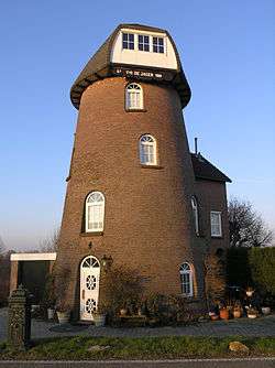
Former windmill in Herwijnen | |
.svg.png) Location in Gelderland | |
| Coordinates: 51°53′N 5°7′E / 51.883°N 5.117°ECoordinates: 51°53′N 5°7′E / 51.883°N 5.117°E | |
| Country | Netherlands |
| Province | Gelderland |
| Established | 1 January 1986 |
| Government[1] | |
| • Body | Municipal council |
| • Mayor | Loes van Ruijven-van Leeuwen (CDA) |
| Area[2] | |
| • Total | 54.49 km2 (21.04 sq mi) |
| • Land | 50.44 km2 (19.47 sq mi) |
| • Water | 4.05 km2 (1.56 sq mi) |
| Elevation[3] | 2 m (7 ft) |
| Population (May 2014)[4] | |
| • Total | 11,033 |
| • Density | 219/km2 (570/sq mi) |
| Time zone | CET (UTC+1) |
| • Summer (DST) | CEST (UTC+2) |
| Postcode | Parts of 4100 and 4200 ranges |
| Area code | 0183, 0345, 0418 |
| Website |
www |
Lingewaal (![]() pronunciation ) is a municipality of the Netherlands.
pronunciation ) is a municipality of the Netherlands.
Population centres
Topography
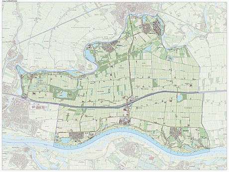
Dutch topographic map of the municipality of Lingewaal, June 2015
References
- ↑ "Samenstelling" [Members] (in Dutch). Gemeente Lingewaal. Retrieved 8 July 2014.
- ↑ "Kerncijfers wijken en buurten" [Key figures for neighbourhoods]. CBS Statline (in Dutch). CBS. 2 July 2013. Retrieved 12 March 2014.
- ↑ "Postcodetool for 4147AN". Actueel Hoogtebestand Nederland (in Dutch). Het Waterschapshuis. Retrieved 8 July 2014.
- ↑ "Bevolkingsontwikkeling; regio per maand" [Population growth; regions per month]. CBS Statline (in Dutch). CBS. 26 June 2014. Retrieved 24 July 2014.
External links
 Media related to Lingewaal at Wikimedia Commons
- Official website
 |
Leerdam (ZH) | Geldermalsen | | |
| Giessenlanden (ZH) Gorinchem (ZH) |
|
Neerijnen | ||
| ||||
| | ||||
| Waal Zaltbommel |

This article is issued from Wikipedia - version of the 2/2/2016. The text is available under the Creative Commons Attribution/Share Alike but additional terms may apply for the media files.