List of churches in Brussels
In Brussels are several church buildings, most of which are attached to the Catholicism, The Capital Region of Brussels is home to 107 Catholic parishes. Other religious buildings in this city were also mentioned.
By municipality
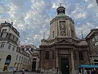
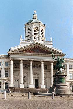
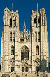
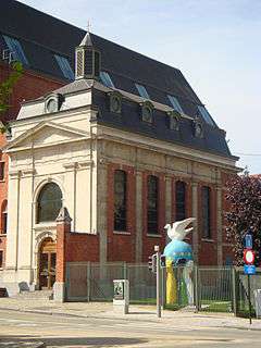
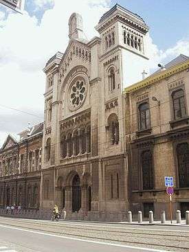
Brussels
.JPG)
.jpg)
.jpg)
_la_grande_Mosqu%C3%A9e.JPG)
Evere
| name | district | coordinates | denomination | photo |
|---|---|---|---|---|
| Church of Our Lady Immaculate Received, Evere | Evere | 50°52′15.43″N 4°24′2.33″E / 50.8709528°N 4.4006472°E | Roman Catholic | 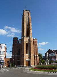 |
| Saint Joseph Church, Evere | Evere | 50°51′31.58″N 4°24′53.43″E / 50.8587722°N 4.4148417°E | Roman Catholic | |
| St. Vincent Church | Evere | 50°52′52.78″N 4°24′11.28″E / 50.8813278°N 4.4031333°E | Roman Catholic |
Haren
| name | district | coordinates | denomination | photo |
|---|---|---|---|---|
| Saint Elisabeth Church, Haren | Haren | 50°53′34.1″N 4°25′2.87″E / 50.892806°N 4.4174639°E | Roman Catholic | 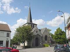 |
Schaarbeek
| name | district | coordinates | denomination | photo |
|---|---|---|---|---|
| Holy-Family Church, Schaarbeek | Schaarbeek | 50°52′25.93″N 4°23′12.07″E / 50.8738694°N 4.3866861°E | Roman Catholic | |
| Epiphany Church | Schaarbeek | 50°51′38.12″N 4°24′11.54″E / 50.8605889°N 4.4032056°E | Roman Catholic | |
| Saint Mary's Royal Church | Schaarbeek | 50°51′32.73″N 4°22′7.58″E / 50.8590917°N 4.3687722°E | Roman Catholic | 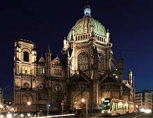 |
| St. Albertus Church, Schaarbeek | Schaarbeek | 50°50′59.38″N 4°23′41.08″E / 50.8498278°N 4.3947444°E | Roman Catholic | 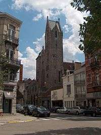 |
| St. Aleydis Church | Schaarbeek | 50°51′18.32″N 4°23′6.73″E / 50.8550889°N 4.3852028°E | Roman Catholic | |
| Saint Elisabeth Church, Schaarbeek | Schaarbeek | 50°52′21.24″N 4°22′29.8″E / 50.8725667°N 4.374944°E | Rooms-katholiek | |
| St. John and Nicholas' Church | Schaarbeek | 50°51′37.82″N 4°21′46.66″E / 50.8605056°N 4.3629611°E | Roman Catholic | 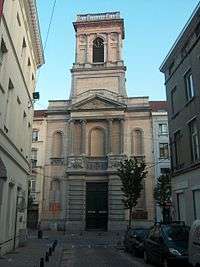 |
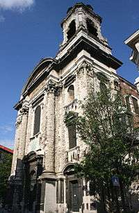
| Saint Servatius Church | Schaarbeek | 50°51′51.77″N 4°22′21.37″E / 50.8643806°N 4.3726028°E | Roman Catholic | _-_2264-0055-0.JPG) |
| St. Susanna Church | Schaarbeek | 50°51′57.13″N 4°23′20.55″E / 50.8658694°N 4.3890417°E | Roman Catholic | |
| St. Therese Church, Schaarbeek | Schaarbeek | 50°51′21.6″N 4°23′43.44″E / 50.856000°N 4.3954000°E | Roman Catholic | |
| Bethel Church, Schaarbeek | Schaarbeek | ??? | Evangelical | |
| Church of the Holy Family | Schaarbeek | ??? | Roman Catholic | |
| Church of the Divine Savior | Schaarbeek | 50°50′58.74″N 4°24′28.96″E / 50.8496500°N 4.4080444°E | Roman Catholic |  |
Sint-Joost-ten-Node
| name | district | coordinates | denomination | photo |
|---|---|---|---|---|
| Saint-Josse Church | Sint-Joost-ten-Node | 50°51′0.58″N 4°22′28.26″E / 50.8501611°N 4.3745167°E | Roman Catholic |
Etterbeek
| name | district | coordinates | denomination | photo |
|---|---|---|---|---|
| Church of Our Lady of the Sacred Heart, Etterbeek | Etterbeek | 50°49′53.52″N 4°24′1.08″E / 50.8315333°N 4.4003000°E | Roman Catholic | |
| Saint John Berchmans Church, Brussels | Etterbeek | 50°50′5″N 4°24′26″E / 50.83472°N 4.40722°E | Roman Catholic | 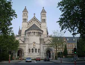 |
| Our Lady Immaculate Church, Etterbeek | Etterbeek | 50°50′3.3″N 4°22′51.77″E / 50.834250°N 4.3810472°E | Roman Catholic | |
| St. Anthony of Padua Church, Brussels | Etterbeek | 50°50′36.41″N 4°20′34.31″E / 50.8434472°N 4.3428639°E | Roman Catholic | 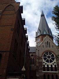 |
| St. Gertrude Church, Etterbeek | Etterbeek | 50°50′11.45″N 4°23′24.45″E / 50.8365139°N 4.3901250°E | Roman Catholic |
Woluwe-Saint-Lambert
| name | district | coordinates | denomination | photo |
|---|---|---|---|---|
| Our Lady Assumption Church, Woluwe-Saint-Lambert | Kapelleveld, Woluwe-Saint-Lambert | 50°50′52.91″N 4°27′4.08″E / 50.8480306°N 4.4511333°E | Roman Catholic | |
| Chapel of Lenneke | Woluwe-Saint-Lambert | 50°50′46″N 4°26′31.99″E / 50.84611°N 4.4422194°E | Roman Catholic | 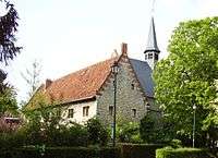 |
| Holy-Family Church, Woluwe-Saint-Lambert | Woluwe-Saint-Lambert | 50°51′0.51″N 4°25′38.58″E / 50.8501417°N 4.4273833°E | Roman Catholic | |
| St. Henricus Church | Woluwe-Saint-Lambert | 50°50′31.37″N 4°24′35.7″E / 50.8420472°N 4.409917°E | Roman Catholic | |
| Saint Lambert Church | Woluwe-Saint-Lambert | 50°50′29.04″N 4°25′59.13″E / 50.8414000°N 4.4330917°E | Roman Catholic | 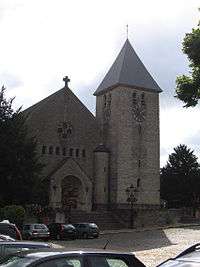 |
Woluwe-Saint-Pierre
| name | district | coordinates | denomination | photo |
|---|---|---|---|---|
| St. Paul's Church, Woluwe-Saint-Pierre | Woluwe-Saint-Pierre | 50°49′47.76″N 4°26′51.08″E / 50.8299333°N 4.4475222°E | Roman Catholic | |
| St. Peters Church, Woluwe-Saint-Pierre | Woluwe-Saint-Pierre | 50°50′17.78″N 4°25′54.26″E / 50.8382722°N 4.4317389°E | Roman Catholic | |
| Church of Our Lady, Stokkel | Woluwe-Saint-Pierre | 50°50′28.61″N 4°27′46″E / 50.8412806°N 4.46278°E | Roman Catholic | |
| St. Aleydis Church, Woluwe-Saint-Pierre | Woluwe-Saint-Pierre | 50°49′41.38″N 4°27′44.32″E / 50.8281611°N 4.4623111°E | Roman Catholic | |
| Our Lady of Grace Church | Woluwe-Saint-Pierre | 50°49′37.38″N 4°25′7.43″E / 50.8270500°N 4.4187306°E | Roman Catholic |
Ganshoren
| name | district | coordinates | denomination | photo |
|---|---|---|---|---|
| St. Cecilia's Church | Ganshoren | 50°52′28.43″N 4°18′12.45″E / 50.8745639°N 4.3034583°E | Roman Catholic | |
| Saint Martin's Church | Ganshoren | 50°52′19.83″N 4°18′52.81″E / 50.8721750°N 4.3146694°E | Roman Catholic |
Koekelberg
| name | district | coordinates | denomination | photo |
|---|---|---|---|---|
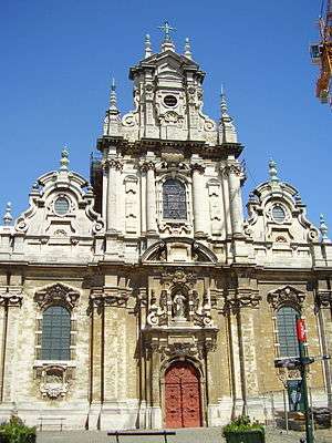
| Basilica of the Sacred Heart, Brussels | Koekelberg | 50°52′1″N 4°19′1″E / 50.86694°N 4.31694°E | Roman Catholic | 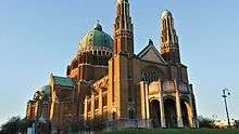 |
| St. Anna Church, Koekelberg | Koekelberg | 50°51′37.36″N 4°19′55.25″E / 50.8603778°N 4.3320139°E | Roman Catholic |
Sint-Agatha-Berchem
| name | district | coordinates | denomination | photo |
|---|---|---|---|---|
| Old St. Agatha Church, Sint-Agatha-Berchem | Sint-Agatha-Berchem | 50°51′48.92″N 4°17′42.97″E / 50.8635889°N 4.2952694°E | Roman Catholic | 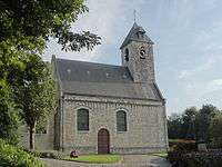 |
Sint-Jans-Molenbeek
| name | district | coordinates | denomination | photo |
|---|---|---|---|---|
| St. Barbara Church, Sint-Jans-Molenbeek | Sint-Jans-Molenbeek | 50°50′59.08″N 4°19′41.5″E / 50.8497444°N 4.328194°E | Roman Catholic | |
| Saint John Baptist Church , Sint-Jans-Molenbeek | Sint-Jans-Molenbeek | 50°51′25.84″N 4°20′25.66″E / 50.8571778°N 4.3404611°E | Roman Catholic | 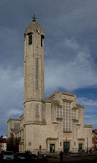 |
| St Remigius Church, Sint-Jans-Molenbeek | Sint-Jans-Molenbeek | 50°51′46.07″N 4°20′18.45″E / 50.8627972°N 4.3384583°E | Roman Catholic | |
| Our Lady Mediatrix Church | Sint-Jans-Molenbeek | 50°51′18.6″N 4°20′39.27″E / 50.855167°N 4.3442417°E | Roman Catholic | |
| St. Charles Borromeo and Good Herder Church | Karreveld-Mettewie, Sint-Jans-Molenbeek | 50°51′31.19″N 4°19′9.18″E / 50.8586639°N 4.3192167°E | Roman Catholic | |
| Resurrection Church, Sint-Jans-Molenbeek | Sint-Jans-Molenbeek | 50°50′52.11″N 4°17′21.62″E / 50.8478083°N 4.2893389°E | Roman Catholic |
Laken
| name | district | coordinates | denomination | photo |
|---|---|---|---|---|
| Christ the King Church , Laken | Mutsaard, Laken | 50°53′56.54″N 4°21′48.61″E / 50.8990389°N 4.3635028°E | Roman Catholic | |
| Saint Lambert Church, Laken | Heizel, Laken | 50°53′26.6″N 4°20′38.13″E / 50.890722°N 4.3439250°E | Roman Catholic | |
| Holy Angels Church | Laken | 50°52′55.04″N 4°20′26.59″E / 50.8819556°N 4.3407194°E | Roman Catholic | |
| Church of Our Lady, Laken | Laken | 50°52′43″N 4°21′21″E / 50.87861°N 4.35583°E | Roman Catholic | 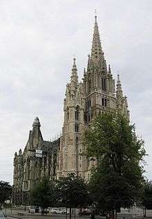 |
| Divine Child Jesus Church, Laken | Verregat, Laken | 50°53′50.62″N 4°19′42″E / 50.8973944°N 4.32833°E | Roman Catholic | 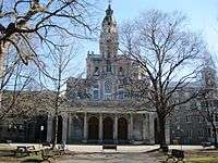 |
Neder-Over-Heembeek
| name | district | coordinates | denomination | photo |
|---|---|---|---|---|
| New St. Peter and Paul Church | Neder-Over-Heembeek | 50°53′45.97″N 4°23′16.85″E / 50.8961028°N 4.3880139°E | Roman Catholic |
Anderlecht
| name | district | coordinates | denomination | photo |
|---|---|---|---|---|
| Holy Spirit Church | Anderlecht | 50°49′38.3″N 4°17′3.92″E / 50.827306°N 4.2844222°E | Roman Catholic | |
| Mission House CICM Church, Anderlecht | Anderlecht | 50°50′49.72″N 4°18′18.41″E / 50.8471444°N 4.3051139°E | Roman Catholic | |
| Our Lady Assumption Church, Anderlecht | Anderlecht | 50°50′20.25″N 4°17′51.3″E / 50.8389583°N 4.297583°E | Roman Catholic | |
| Our Lady of the Sacred Heart Church | Anderlecht | 50°50′40.9″N 4°18′55.33″E / 50.844694°N 4.3153694°E | Roman Catholic | |
| Our Lady of Joy Church, Anderlecht | Anderlecht | 50°48′56.38″N 4°17′0.57″E / 50.8156611°N 4.2834917°E | Roman Catholic | |
| St. Bernadette Church, Anderlecht | Anderlecht | 50°50′7.28″N 4°16′32.67″E / 50.8353556°N 4.2757417°E | Roman Catholic | |
| Saint-Gerard-Majella Church | Neerpede, Anderlecht | 50°49′34.77″N 4°16′37.18″E / 50.8263250°N 4.2769944°E | Roman Catholic | |
| St. Lucas Church | Anderlecht | 50°49′52.62″N 4°18′37.16″E / 50.8312833°N 4.3103222°E | Roman Catholic | |
| St. Peter's and St. Guido Church | Anderlecht | 50°50′11.81″N 4°18′22.38″E / 50.8366139°N 4.3062167°E | Roman Catholic | 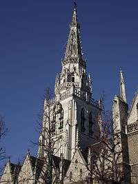 |
| Saint Joseph Church, Anderlecht | Het Rad, Anderlecht | 50°49′22.16″N 4°17′50.26″E / 50.8228222°N 4.2972944°E | Roman Catholic |  |
| Church of Our Lady Immaculate Received, Anderlecht | Kuregem, Anderlecht | 50°50′34.94″N 4°20′7.03″E / 50.8430389°N 4.3352861°E | Roman Catholic | |
| Israel Orthodox Synagogue Kuregem | Anderlecht | ??? | Judaism |
Audergem
| name | district | coordinates | denomination | photo |
|---|---|---|---|---|
| Our Lady Of Caucasian Dell Church | Auderghem | 50°48′23.38″N 4°26′15.27″E / 50.8064944°N 4.4375750°E | Roman Catholic | |
| St. Anne's Church, Auderghem | Auderghem | 50°48′57.25″N 4°26′1.41″E / 50.8159028°N 4.4337250°E | Roman Catholic |  |
| St. Julien Church | Auderghem | 50°49′16.3″N 4°24′34.77″E / 50.821194°N 4.4096583°E | Roman Catholic |
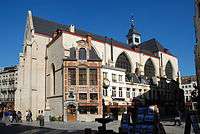
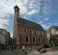
Ixelles
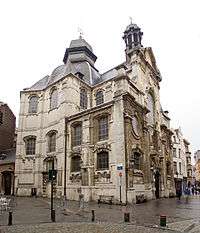
_-_Brussels_-_2071-0003-0.jpg)
Jette
| name | district | coordinates | denomination | photo |
|---|---|---|---|---|
| St. Clara Church, Jette | Jette | 50°53′32.19″N 4°19′21.38″E / 50.8922750°N 4.3226056°E | Roman Catholic | |
| Saint Joseph Church, Jette | Dielegem, Jette | 50°53′11.58″N 4°19′9.35″E / 50.8865500°N 4.3192639°E | Roman Catholic | |
| Our Lady of Lourdes Church, Jette | Jette | 50°52′23.8″N 4°20′7.26″E / 50.873278°N 4.3353500°E | Roman Catholic | |
| St. Peters Church, Jette | Jette | 50°52′49.37″N 4°19′49.92″E / 50.8803806°N 4.3305333°E | Roman Catholic |  |
Uccle
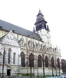
.JPG)
Saint-Gillis
| name | district | coordinates | denomination | photo |
|---|---|---|---|---|
| Jesus Worker Church | Sint-Gillis | 50°49′35.15″N 4°20′16.4″E / 50.8264306°N 4.337889°E | Roman Catholic | |
| St. Alena Church | Sint-Gillis | 50°49′28.39″N 4°20′27.08″E / 50.8245528°N 4.3408556°E | Roman Catholic | 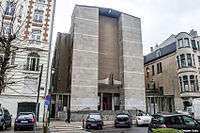 |
| St. Bernard Church, Saint-Gillis | Sint-Gillis | 50°49′50.18″N 4°21′14.27″E / 50.8306056°N 4.3539639°E | Roman Catholic | |
| St Giles' Church, Saint-Gillis | Sint-Gillis | 50°49′50.19″N 4°20′37.47″E / 50.8306083°N 4.3437417°E | Roman Catholic |
Vorst
| name | district | coordinates | denomination | photo |
|---|---|---|---|---|
| Holy Mary Mother of God Church | Vorst | 50°49′12.66″N 4°19′44.65″E / 50.8201833°N 4.3290694°E | Roman Catholic | |
| Holy Father Van Ars Church | Vorst | 50°48′21.37″N 4°19′14.41″E / 50.8059361°N 4.3206694°E | Roman Catholic | |
| Saint Pius X Church | Vorst | 50°48′29.82″N 4°19′57.77″E / 50.8082833°N 4.3327139°E | Roman Catholic | |
| St. Anthony of Padua Church | Vorst | 50°49′40.29″N 4°19′54.13″E / 50.8278583°N 4.3317028°E | Roman Catholic | |
| Saint Augustine Church, Vorst | Hoogte Honderd, Vorst | 50°48′59.96″N 4°20′12.33″E / 50.8166556°N 4.3367583°E | Roman Catholic | 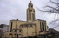 |
| Barnabites Church | Vorst | 50°49′7.18″N 4°21′2.76″E / 50.8186611°N 4.3507667°E | Roman Catholic | 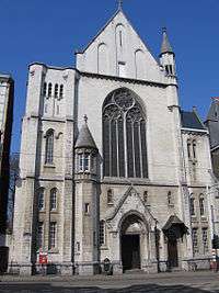 |
| Saint-Denis Church, Vorst | Vorst | 50°48′40.11″N 4°19′3.84″E / 50.8111417°N 4.3177333°E | Roman Catholic | 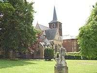 |
Watermael-Boitsfort
| name | district | coordinates | denomination | photo |
|---|---|---|---|---|
| Our Lady of Perpetual Help Church | Watermael-Boitsfort | 50°48′30.97″N 4°25′3.97″E / 50.8086028°N 4.4177694°E | Roman Catholic | |
| Church of St Clement, Watermael-Boitsfort | Watermael-Boitsfort | 50°48′35.93″N 4°24′20.96″E / 50.8099806°N 4.4058222°E | Roman Catholic | 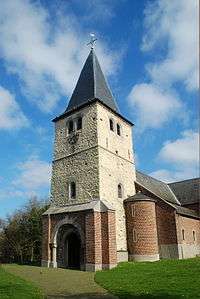 |
| Holy Cross Church, Watermael-Boitsfort | Watermael-Boitsfort | 50°48′1.03″N 4°23′57.62″E / 50.8002861°N 4.3993389°E | Roman Catholic | |
| Queen of Heaven Church | Watermael-Boitsfort | 50°47′24.02″N 4°25′18.71″E / 50.7900056°N 4.4218639°E | Roman Catholic | |
| St. Hubert Church, Watermael | Watermael-Boitsfort | 50°47′46.8″N 4°24′50.44″E / 50.796333°N 4.4140111°E | Roman Catholic |
References
This article is issued from Wikipedia - version of the 8/4/2016. The text is available under the Creative Commons Attribution/Share Alike but additional terms may apply for the media files.