Lovászpatona
| Lovászpatona | |
|---|---|
 Lovászpatona Location of Lovászpatona | |
| Coordinates: 47°25′57″N 17°37′34″E / 47.43245°N 17.62603°ECoordinates: 47°25′57″N 17°37′34″E / 47.43245°N 17.62603°E | |
| Country |
|
| County | Veszprém |
| Area | |
| • Total | 49.9 km2 (19.3 sq mi) |
| Population (2004) | |
| • Total | 1,318 |
| • Density | 26.41/km2 (68.4/sq mi) |
| Time zone | CET (UTC+1) |
| • Summer (DST) | CEST (UTC+2) |
| Postal code | 8553 |
| Area code(s) | 89 |
Lovászpatona is a village in Veszprém county, Hungary.
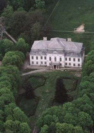
Aerialphotography: Lovászpatona, palace
External links
This article is issued from Wikipedia - version of the 2/6/2014. The text is available under the Creative Commons Attribution/Share Alike but additional terms may apply for the media files.