Môle-Saint-Nicolas Airport
| Môle-Saint-Nicolas Airport | |||||||||||
|---|---|---|---|---|---|---|---|---|---|---|---|
| IATA: none – ICAO: none | |||||||||||
| Summary | |||||||||||
| Airport type | Public | ||||||||||
| Serves | Môle-Saint-Nicolas | ||||||||||
| Elevation AMSL | 63 ft / 19 m | ||||||||||
| Coordinates | 19°50′05″N 73°21′30″W / 19.83472°N 73.35833°WCoordinates: 19°50′05″N 73°21′30″W / 19.83472°N 73.35833°W | ||||||||||
| Map | |||||||||||
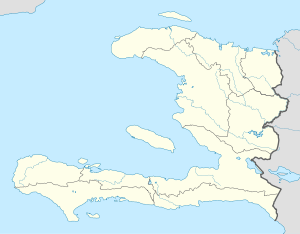 Môle-Saint-Nicolas Location of the airport in Haiti | |||||||||||
| Runways | |||||||||||
| |||||||||||
|
Sources: Google Maps[1] | |||||||||||
Môle-Saint-Nicolas Airport is an airstrip 3.52 kilometres (2.19 mi) northeast of Môle-Saint-Nicolas, a commune in the Nord-Ouest Department of Haiti.
The runway is at the base of a small 8 kilometres (5.0 mi) peninsula that forms the bay of Môle. There is rising terrain southeast of the airport.
See also
 Haiti portal
 Aviation portal
- Transport in Haiti
- List of airports in Haiti
References
External links
This article is issued from Wikipedia - version of the 12/5/2016. The text is available under the Creative Commons Attribution/Share Alike but additional terms may apply for the media files.