Manduri
| Manduri | ||
|---|---|---|
| Municipality | ||
 | ||
| ||
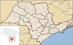 Location in São Paulo state | ||
 Manduri Location in Brazil | ||
| Coordinates: 23°0′12″S 49°19′19″W / 23.00333°S 49.32194°WCoordinates: 23°0′12″S 49°19′19″W / 23.00333°S 49.32194°W | ||
| Country |
| |
| Region | Southeast Region | |
| State | São Paulo | |
| Area | ||
| • Total | 229 km2 (88 sq mi) | |
| Elevation | 710 m (2,330 ft) | |
| Population (2015) | ||
| • Total | 9,592 | |
| • Density | 42/km2 (110/sq mi) | |
| Time zone | BRT/BRST (UTC-3/-2) | |

Manduri is a municipality (município) in the state of São Paulo in Brazil. The population is 9,592 (2015 est.) in an area of 229 km².[1] The elevation is 710 m.
Pictures
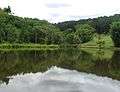 The forest, in Manduri
_REFON.jpg) Black capuchin
Black capuchin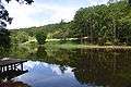 Forest
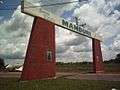 Portal
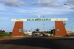
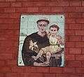 Detail in the portal, Santo Antonio picture
.JPG) A street with trees
A street with trees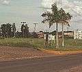 Intersection from Manduri to Águas de Sta. Bárbara
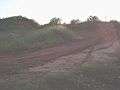 Motocross track
References
This article is issued from Wikipedia - version of the 5/14/2016. The text is available under the Creative Commons Attribution/Share Alike but additional terms may apply for the media files.