Maricourt
- For the medieval French scientist, see Peter of Maricourt.
| Maricourt | |
|---|---|
 Maricourt | |
|
Location within Hauts-de-France region  Maricourt | |
| Coordinates: 49°58′52″N 2°47′09″E / 49.9811°N 2.7858°E / 49.9811; 2.7858Coordinates: 49°58′52″N 2°47′09″E / 49.9811°N 2.7858°E / 49.9811; 2.7858 | |
| Country | France |
| Region | Hauts-de-France |
| Department | Somme |
| Arrondissement | Péronne |
| Canton | Combles |
| Intercommunality | Canton of Combles |
| Government | |
| • Mayor (2001–2008) | Bernard Guillemont |
| Area1 | 7.52 km2 (2.90 sq mi) |
| Population (2006)2 | 161 |
| • Density | 21/km2 (55/sq mi) |
| Time zone | CET (UTC+1) |
| • Summer (DST) | CEST (UTC+2) |
| INSEE/Postal code | 80513 / 80360 |
| Elevation |
55–129 m (180–423 ft) (avg. 125 m or 410 ft) |
|
1 French Land Register data, which excludes lakes, ponds, glaciers > 1 km² (0.386 sq mi or 247 acres) and river estuaries. 2 Population without double counting: residents of multiple communes (e.g., students and military personnel) only counted once. | |
Maricourt is a commune in the Somme department in Hauts-de-France in northern France. It is twinned with Brundall, Norfolk, England.
Geography
Maricourt is situated on the D938 road, some 30 miles (48 km) southeast of Amiens.
Population
| 1962 | 1968 | 1975 | 1982 | 1990 | 1999 | 2006 |
|---|---|---|---|---|---|---|
| 172 | 187 | 165 | 146 | 137 | 145 | 161 |
| Starting in 1962: Population without duplicates | ||||||
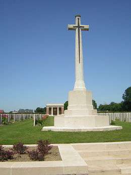
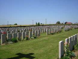
The Commonwealth Cemetery
See also
References
External links
| Wikimedia Commons has media related to Maricourt. |
- Maricourt on the Quid website (French)
This article is issued from Wikipedia - version of the 11/8/2016. The text is available under the Creative Commons Attribution/Share Alike but additional terms may apply for the media files.