Marie-Galante Airport
| Marie-Galante Airport | |||||||||||
|---|---|---|---|---|---|---|---|---|---|---|---|
| IATA: GBJ – ICAO: TFFM | |||||||||||
| Summary | |||||||||||
| Airport type | Public | ||||||||||
| Operator | Conseil Général de la Guadeloupe | ||||||||||
| Serves | Grand-Bourg, Marie-Galante, Guadeloupe | ||||||||||
| Elevation AMSL | 17 ft / 5 m | ||||||||||
| Coordinates | 15°52′07″N 061°16′20″W / 15.86861°N 61.27222°WCoordinates: 15°52′07″N 061°16′20″W / 15.86861°N 61.27222°W | ||||||||||
| Map | |||||||||||
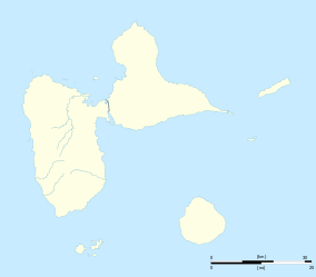 TFFM Location in Guadeloupe | |||||||||||
| Runways | |||||||||||
| |||||||||||
Marie-Galante Airport (IATA: GBJ, ICAO: TFFM) is an airport serving the island of Marie-Galante in Guadeloupe.[1] It is located 5.5 km (3.0 NM) east of Grand-Bourg,[1] one of three communes on the island.
The Marie Galante non-directional beacon (Ident: MG) is located on the field.[4]
See also
.svg.png) Guadeloupe portal
Guadeloupe portal Aviation portal
- Transport in Guadeloupe
- List of airports in Guadeloupe
References
- 1 2 3 TFFM – Marie Galante. AIP from French Service d'information aéronautique, effective 8 December 2016.
- ↑ Google Maps - Marie-Galante
- ↑ Airport information for GBJ at Great Circle Mapper.
- ↑ OurAirports - MG NDB
External links
- Accident history for Marie Galante-Les Bases Airport (GBJ / TFFM) at Aviation Safety Network
- OpenStreetMap - Marie-Galante
- SkyVector - Marie-Galante
- OurAirports - Marie-Galante
This article is issued from Wikipedia - version of the 12/4/2016. The text is available under the Creative Commons Attribution/Share Alike but additional terms may apply for the media files.