Marion Township, Boone County, Indiana
| Marion Township | |
|---|---|
| Township | |
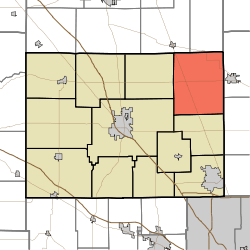 Location of Marion Township in Boone County | |
| Coordinates: 40°07′16″N 86°17′33″W / 40.12111°N 86.29250°WCoordinates: 40°07′16″N 86°17′33″W / 40.12111°N 86.29250°W | |
| Country | United States |
| State | Indiana |
| County | Boone |
| Government | |
| • Type | Indiana township |
| Area | |
| • Total | 45.94 sq mi (119.0 km2) |
| • Land | 45.93 sq mi (119.0 km2) |
| • Water | 0.01 sq mi (0.03 km2) |
| Elevation[1] | 951 ft (290 m) |
| Population (2010) | |
| • Total | 1,233 |
| • Density | 26.8/sq mi (10.3/km2) |
| FIPS code | 18-46854[2] |
| GNIS feature ID | 453603 |
Marion Township is one of twelve townships in Boone County, Indiana. As of the 2010 census, its population was 1,233 and it contained 506 housing units.[3]
Geography
According to the 2010 census, the township has a total area of 45.94 square miles (119.0 km2), of which 45.93 square miles (119.0 km2) (or 99.98%) is land and 0.01 square miles (0.026 km2) (or 0.02%) is water.[3]
Unincorporated towns
Adjacent townships
- Center (southwest)
- Clinton (west)
- Union (south)
- Adams Township, Hamilton County (east)
- Kirklin Township, Clinton County (northwest)
- Sugar Creek Township, Clinton County (north)
- Washington Township, Hamilton County (southeast)
Major highways
Cemeteries
The township contains two cemeteries: Bethel and Parr-Jones.
References
- ↑ "US Board on Geographic Names". United States Geological Survey. 2007-10-25. Retrieved 2008-01-31.
- ↑ "American FactFinder". United States Census Bureau. Retrieved 2008-01-31.
- 1 2 "Population, Housing Units, Area, and Density: 2010 - County -- County Subdivision and Place -- 2010 Census Summary File 1". United States Census. Retrieved 2013-05-10.
External links
Municipalities and communities of Boone County, Indiana, United States | ||
|---|---|---|
| City | ||
| Towns | ||
| Townships | ||
| Unincorporated communities |
| |
| Footnotes | ‡This populated place also has portions in an adjacent county or counties | |
This article is issued from Wikipedia - version of the 7/30/2014. The text is available under the Creative Commons Attribution/Share Alike but additional terms may apply for the media files.