Marovoay District
For other places with the same name, see Marovoay.
| Marovoay District | |
|---|---|
| District | |
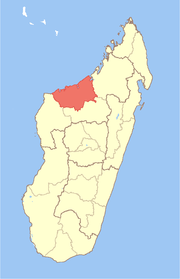
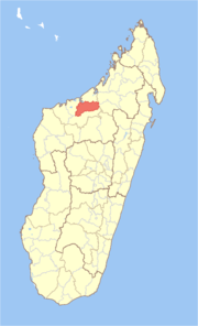 Location in Madagascar | |
| Coordinates: 16°9′S 46°37′E / 16.150°S 46.617°E | |
| Country |
|
| Region | Boeny |
| Area | |
| • Total | 3,804 km2 (1,469 sq mi) |
| Population (2013) | |
| • Total | 182,742 |
| • Density | 48/km2 (120/sq mi) |
| Time zone | EAT (UTC3) |
Marovoay is a district in northwestern Madagascar. It is a part of Boeny Region and borders the districts of Mahajanga II in north, Boriziny and Mampikony in east, Ambato-Boeni in south and Mitsinjo in west. The area is 3,804 km2 (1,469 sq mi) and the population was estimated to be 182,742 in 2013.[1]
The district is further divided into 12 communes.
References and notes
- ↑ Institut National de la Statistique, Madagascar.
Coordinates: 16°9′S 46°37′E / 16.150°S 46.617°E
This article is issued from Wikipedia - version of the 8/25/2015. The text is available under the Creative Commons Attribution/Share Alike but additional terms may apply for the media files.