Marum
For other uses, see Marum (disambiguation).
| Marum | |||
|---|---|---|---|
| Municipality | |||
|
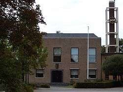
Marum town hall | |||
| |||
.svg.png) Location in Groningen | |||
| Coordinates: 53°9′N 6°16′E / 53.150°N 6.267°ECoordinates: 53°9′N 6°16′E / 53.150°N 6.267°E | |||
| Country | Netherlands | ||
| Province | Groningen | ||
| Government[1] | |||
| • Body | Municipal council | ||
| • Mayor | Henk Kosmeijer (PvdA) | ||
| Area[2] | |||
| • Total | 64.89 km2 (25.05 sq mi) | ||
| • Land | 64.52 km2 (24.91 sq mi) | ||
| • Water | 0.37 km2 (0.14 sq mi) | ||
| Elevation[3] | 3 m (10 ft) | ||
| Population (May 2014)[4] | |||
| • Total | 10,343 | ||
| • Density | 160/km2 (400/sq mi) | ||
| Time zone | CET (UTC+1) | ||
| • Summer (DST) | CEST (UTC+2) | ||
| Postcode | 9360–9369, 9824–9825 | ||
| Area code | 0594 | ||
| Website |
www | ||


Marum (Dutch pronunciation: [ˈmaːrɵm]) is a municipality and a town in the northeastern Netherlands.
Population centres
Boerakker, Jonkersvaart, Lucaswolde, Marum, Niebert, Noordwijk, Nuis, De Wilp.
Topography
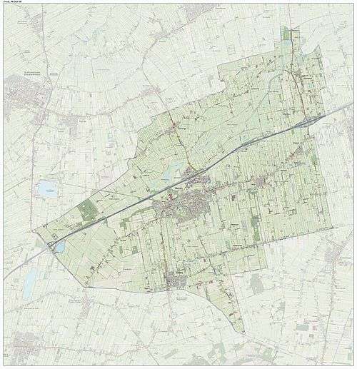
Dutch Topographic map of the municipality of Marum, June 2015
References
- ↑ "Samenstelling B en W" [Members of the board of mayor and aldermen] (in Dutch). Gemeente Marum. Retrieved 30 January 2014.
- ↑ "Kerncijfers wijken en buurten" [Key figures for neighbourhoods]. CBS Statline (in Dutch). CBS. 2 July 2013. Retrieved 12 March 2014.
- ↑ "Postcodetool for 9363BA". Actueel Hoogtebestand Nederland (in Dutch). Het Waterschapshuis. Retrieved 30 January 2014.
- ↑ "Bevolkingsontwikkeling; regio per maand" [Population growth; regions per month]. CBS Statline (in Dutch). CBS. 26 June 2014. Retrieved 24 July 2014.
External links
| Wikimedia Commons has media related to Marum. |
 |
Grootegast | | ||
| Smallingerland (FR) | |
Leek | ||
| ||||
| | ||||
| Opsterland (FR) |
Municipalities of Groningen | ||
|---|---|---|
 | ||
| ||
This article is issued from Wikipedia - version of the 4/6/2016. The text is available under the Creative Commons Attribution/Share Alike but additional terms may apply for the media files.