McGinty Mountain
| McGinty Mountain | |
|---|---|
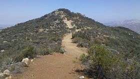 Top of McGinty Mountain | |
| Highest point | |
| Elevation | 2,183 ft (665 m) |
| Coordinates | 32°45′09″N 116°51′38″W / 32.752583°N 116.860489°WCoordinates: 32°45′09″N 116°51′38″W / 32.752583°N 116.860489°W |
| Geography | |
| Location | San Diego County, California, U.S. |
McGinty Mountain is a mountain located in San Diego County.
The chaparral covered mountain is part of the Cleveland National Forest and accessible through a hiking trail.[1]
References
This article is issued from Wikipedia - version of the 12/26/2015. The text is available under the Creative Commons Attribution/Share Alike but additional terms may apply for the media files.