Mississippi Highway 4
| ||||
|---|---|---|---|---|
| Route information | ||||
| Maintained by MDOT | ||||
| Length: | 144.700 mi[1] (232.872 km) | |||
| Major junctions | ||||
| West end: | Fox Island | |||
|
| ||||
| East end: |
| |||
| Location | ||||
| Counties: | Tunica, Tate, Marshall, Benton, Tippah, Prentiss, Tishomingo | |||
| Highway system | ||||
| ||||

Mississippi Highway 4 runs east–west from an intersection in the community of Fox Island west of Tunica, Mississippi, near the border with Arkansas, to Mississippi Highway 25 in Tishomingo County, Mississippi. It travels a distance of 144 miles (232 km), serving Tunica, Tate, Marshall, Benton, Tippah, Prentiss, and Tishomingo Counties.
Locales en route
From west to east
Major intersections
| County | Location | mi | km | Destinations | Notes |
|---|---|---|---|---|---|
| Tunica | Fox Island | Mississippi River levee | |||
| Tunica | west end of US 61 overlap | ||||
| Evansville | east end of US 61 overlap | ||||
| | west end of MS 3 overlap | ||||
| Tate | | east end of MS 3 overlap | |||
| Senatobia | |||||
| I-55 exit 265 | |||||
| | |||||
| Marshall | | ||||
| | west end of MS 7 overlap | ||||
| Holly Springs | I-22 exit 30 | ||||
| east end of MS 7 overlap; former MS 178 west | |||||
| East Van Dorn Avenue | former MS 178 east | ||||
| Eddie Lee Smith Drive | northern bypass of Holly Springs | ||||
| Benton | Ashland | west end of MS 5 overlap | |||
| | east end of MS 5 overlap | ||||
| Tippah | Ripley | west end of MS 15 overlap | |||
| east end of MS 15 overlap | |||||
| | |||||
| Prentiss | Booneville | interchange | |||
| Tuscumbia Road - Tuscumbia | |||||
| East Church Street - Tishomingo, Downtown Booneville, Crows Neck Education Center | former MS 30 | ||||
| | interchange | ||||
| Hobo Station | |||||
| Tishomingo | | Natchez Trace | interchange | ||
| Dennis | |||||
| 1.000 mi = 1.609 km; 1.000 km = 0.621 mi | |||||
See also
 Mississippi portal
 U.S. Roads portal
References
- ↑ "Mississippi Public Roads Selected Statistics" (PDF). Mississippi Department of Transportation. 2008. Retrieved 2010-06-03.
Roads of Memphis | |||||||||||
|---|---|---|---|---|---|---|---|---|---|---|---|
| Interstate Highways | 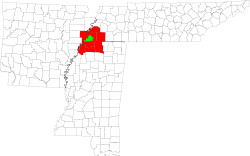 | ||||||||||
| U.S. Highways | |||||||||||
| State Highways |
| ||||||||||
| Other Highways | |||||||||||
This article is issued from Wikipedia - version of the 12/31/2015. The text is available under the Creative Commons Attribution/Share Alike but additional terms may apply for the media files.