Moel y Cerrig Duon
| Moel y Cerrig Duon | |
|---|---|
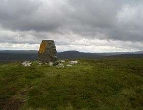 Moel y Cerrig Duon from Foel y Geifr summit | |
| Highest point | |
| Elevation | 625 m (2,051 ft) |
| Prominence | 80 m (260 ft) |
| Parent peak | Esgeiriau Gwynion |
| Listing | Hewitt, Nuttall |
| Naming | |
| Translation | bare hill of the black rocks (Welsh) |
| Geography | |
| Location | Gwynedd, Wales |
| Parent range | Aran Fawddwy |
| Topo map | OS Landranger 125 |
Moel y Cerrig Duon is a subsidiary summit of Esgeiriau Gwynion in Gwynedd in north east Wales.
Moel y Cerrig Duon tops the eastern end of a long peat bog plateau along with Llechwedd Du. Its summit has a conical shape, rising suddenly from the bog. The summit itself is grassy, marked by a small cairn and a stake. To the north-east is Foel y Geifr, to the east Cyrniau Nod and to the west is Llechwedd Du, Esgeiriau Gwynion, and Aran Fawddwy.
The Aran range continues south from Moel y Cerrig Duon forming a large area of high moorland to the west of Lake Vyrnwy, crowned by Mynydd Coch. To the north it continues to Foel y Geifr, the eastern outpost of the Aran Fawddwy range.[1]
References
- ↑ Nuttall, John & Anne (1999). The Mountains of England & Wales - Volume 1: Wales (2nd edition ed.). Milnthorpe, Cumbria: Cicerone. ISBN 1-85284-304-7.
Coordinates: 52°52′48″N 3°22′55″W / 52.88011°N 3.38191°W
This article is issued from Wikipedia - version of the 1/24/2016. The text is available under the Creative Commons Attribution/Share Alike but additional terms may apply for the media files.